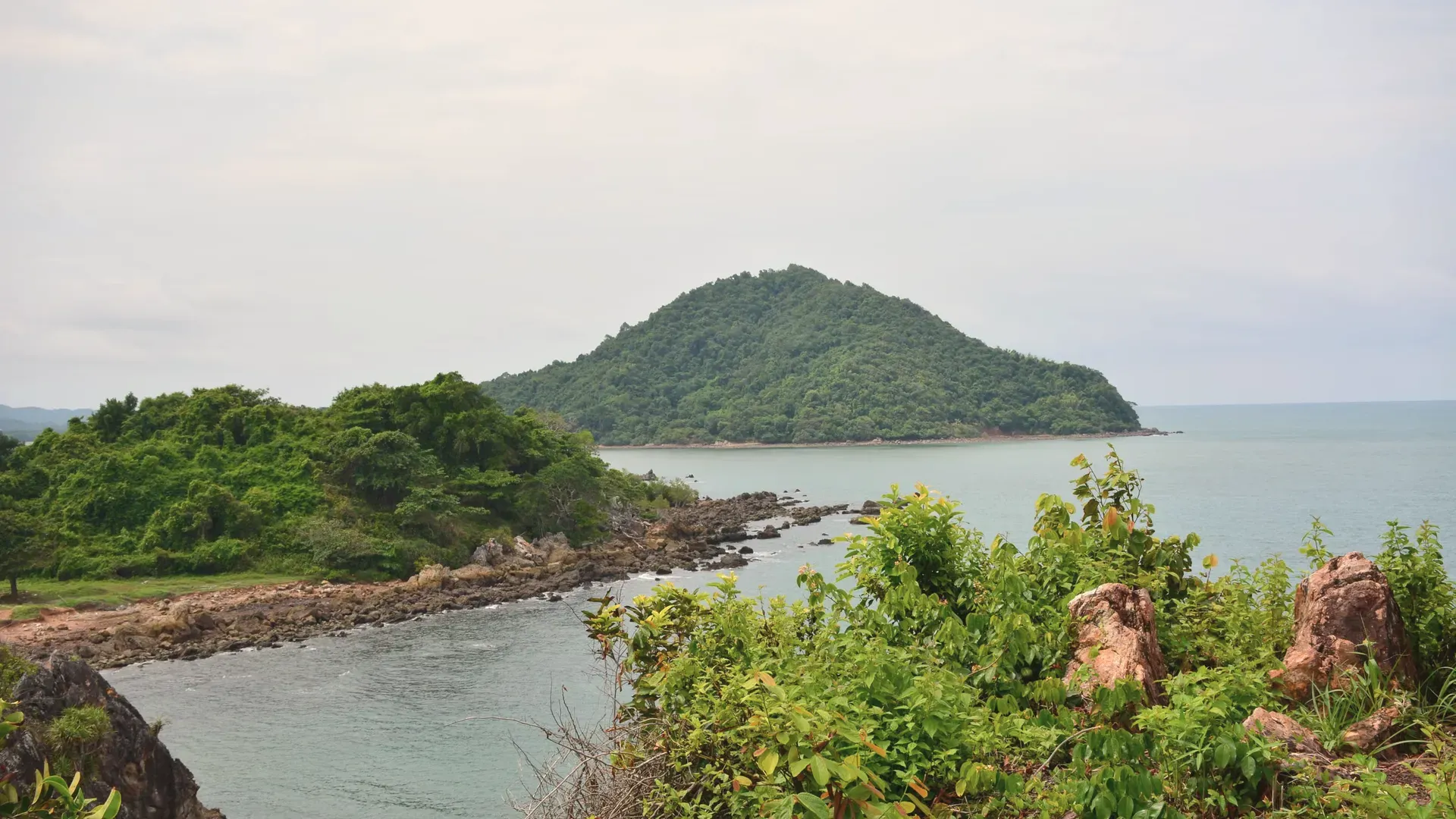
Chanthaburi is an eastern-seaboard province about 245 km from Bangkok, known for durian and other fruit, a gem trade, an old riverside quarter and national parks. Sourced from NSO, DNP and the provincial office.
EastRegion
Mueang ChanthaburiProvincial capital
จันทบุรีThai name
Registered population
Chanthaburi had 534,609 people in the civil registration system in August 2026 (529,522 Thai nationals and 5,087 registered non-Thai nationals), according to the Department of Provincial Administration. That is the 48th largest registered population of Thailand's 77 provinces and about 0.8 percent of the national registered total of 65,677,170.
This is the number of people entered in the house registration system for the province, not a count of everyone who lives there. People who work in another province often stay registered at home, and most foreigners on short stays are not in the registry at all. Official table for August 2026 (read by BAANLYY on 14 November 2026) · Compare all 77 provinces
About Chanthaburi
Chanthaburi sits on the Gulf of Thailand coast in the east, about 245 kilometres from Bangkok in a straight measure and between 248 and 330 kilometres by the road routes the National Statistical Office (NSO) describes. The province covers 6,338 square kilometres, which the NSO report says is 1.8 percent of Thailand. It has forested hills and national parks in the north and east, orchard country in the middle, and a flat, muddy coast with mangroves in the south.
The NSO report puts the population at 536,388 in 2024, spread over ten districts. The economy runs on fruit, above all durian, mangosteen, longan and rambutan, and on a long-standing trade in gemstones. A visitor finds an old Chinese and Vietnamese riverside quarter, a French-era cathedral, a waterfall national park and a royal coastal study centre. Someone weighing a move finds a mid-sized provincial city, a rainy climate and an economy tied to the harvest.
Understand two things first. This is a working agricultural and trading province, not a resort strip, and the official sources we could open say little about foreign residents, rents or house prices. BAANLYY does not yet have local listings, partnered landlords or property managers in Chanthaburi, so treat this page as a reference guide and check everything on the ground.
Chanthaburi at a glance
Region
Eastern Thailand, Gulf of Thailand coast, between latitudes 12 and 13 degrees north source
Area
6,338 square kilometres (3,961,250 rai), which is 16.6 percent of the eastern region and 1.8 percent of Thailand, NSO provincial statistical report 2025 source
Registered population
536,388 people in 2024 (261,555 men, 48.8 percent, and 274,833 women, 51.2 percent), as given in the NSO report; 41.9 percent lived in municipal areas source
Administrative divisions
10 districts, 76 sub-districts and 731 villages in 2024 source
Distance from Bangkok
About 245 kilometres; by road the NSO report gives routes of 248 km (via the motorway), 266 km, 308 km and about 330 km source
Gross provincial product
145,563 million baht in 2023, or 253,522 baht per person; 5th in the eastern region and 12th in Thailand, as reported by NSO from the national planning agency source
Rainfall in 2024
3,355.3 millimetres over 155 rainy days; wettest month July with 968.6 mm source
Temperature range in 2024
Lowest monthly reading 19.8 C in December; highest 37.5 C in May source
Forest cover
1,289,620 rai (32.6 percent of the province) in 2023, with 18 national reserve forests and 3 national parks source
Chanthaburi lies between roughly 12 and 13 degrees north and 101 and 102 degrees east. The NSO report says it borders Chachoengsao and Sa Kaeo provinces to the north, Trat and Cambodia to the east, the Gulf of Thailand to the south, and Rayong and Chonburi to the west.
The NSO report sorts the land into three types. The north and east are forest, mountains and hills at 30 to 190 metres, covering the districts of Kaeng Hang Maeo, Tha Mai, Makham, Soi Dao, Pong Nam Ron and the upper part of Khlung, much of it reserve forest, national park or wildlife area. The middle is plain broken by hills, around Mueang Chanthaburi and Khao Khitchakut, where the orchards are. The coast, in Nayai Am, Laem Sing and lower Tha Mai and Khlung, is low and flat at 1 to 5 metres, with mangrove.
The report names four natural rivers: the Chanthaburi River, which rises in the Khao Soi Dao Tai area and reaches the sea at Laem Sing; the Phang Rat; the Welu, which exits at Ko Chik in Khlung; and the Khlong Wang Tanot. It lists three national parks (Khao Khitchakut, Namtok Phlio and Khao Chamao-Khao Wong), three wildlife sanctuaries (Khao Soi Dao, Khao Ang Rue Nai and Khlong Khruea Wai) and the Khung Krabaen non-hunting area.
Climate and the seasons
Chanthaburi is hot and wet. The NSO report says rain falls steadily for about six to seven months of the year. In 2024 the province recorded 155 rainy days and 3,355.3 millimetres of rain, with July the wettest month at 968.6 millimetres.
The same report gives the 2024 monthly extremes: 19.8 degrees Celsius as the coolest reading, in December, and 37.5 degrees as the hottest, in May. These are one year's figures from the NSO report, not official long-term averages, so plan around the pattern rather than the exact numbers. If you are weighing a stay, expect the heaviest rain mid-year and dry, warm weather through the turn of the year. We did not find official flood or storm-risk figures for individual districts, so we give none.
History and culture
The NSO report calls Chanthaburi an old town and says it is believed to be at least 1,000 years old, built by the Chong people, though some accounts credit the Khmer. The report names a legendary ruler, King Phromathat, and places the original town near Khao Sa Bap. The provincial office adds that archaeological surveys have found polished stone tools from prehistoric times. Treat the early dates as tradition rather than record.
The town moved more than once: to Ban Hua Wang around BE 1800, then in BE 2200 (about 1657) to Ban Lum on the west bank of the Chanthaburi River. After the fall of Ayutthaya, the report says, King Taksin took Chanthaburi in BE 2310 (1767), using it to gather food and troops before retaking the capital. His shrine in the town still draws visitors.
In 1893 (BE 2436) France occupied Chanthaburi for 11 years during a border dispute, and the report says Siam gave up Trat and Koh Kong to get it back. Chanthaburi then served as the seat of a circle (monthon) with Rayong and Trat until BE 2476 (1933), when it became an ordinary province. Local festivals in the report include the Phra Bat Phluang pilgrimage at Khao Khitchakut, a Songkran cart-pulling at Wat Taphon Yai in Khlung said to be over 100 years old, and a May fruit fair with a gem market.
How people earn a living here
The NSO report puts Chanthaburi's gross provincial product at 145,563 million baht in 2023, or 253,522 baht per head. That ranks fifth in the eastern region and twelfth in the country, which makes it one of the better-off provinces by output per person.
The money comes from fruit and gems. The report names durian, mangosteen, longan, rambutan and langsat, and says many people also trade in gems, jewellery and household-scale businesses. The mineral list includes sapphire, ruby, emerald and other stones, plus construction stone, silica sand and kaolin. The provincial industry office counted 306 industrial establishments in 2024 with about 9,811.7 million baht of registered capital, most in Mueang Chanthaburi (83) and Soi Dao (56).
A practical point: an economy built on a seasonal harvest means busy and quiet periods in town life. The report's tourism and employment tables are long; we did not open them, so we give no job or visitor figures.
Getting to Chanthaburi
The NSO report lists five road routes from Bangkok. Highway 3, the old route through Chonburi, Pattaya and Rayong, is about 330 kilometres. Highway 36 and Highway 3 together are about 308. Highway 344 (Ban Bueng to Klaeng) then Highway 3 is about 266. The motorway (Highway 7) to Pattaya, then Highway 36 and Highway 3, totals about 248 kilometres. A fifth route links the northeast, from Kabin Buri on Highway 33 to Highway 317, about 219 kilometres to Chanthaburi.
The report describes only road routes. We did not find an official source this run for bus timetables, rail service, the nearest commercial airport or flight times, so we list none. Inside the province, the sights are spread across ten districts of orchards, hills and coast, so you will want your own car or motorbike.
Places worth knowing in Chanthaburi
Namtok Phlio National Park (อุทยานแห่งชาติน้ำตกพลิ้ว)
National park and waterfall
The park spans Mueang, Laem Sing, Khlung and Makham districts. The NSO report describes forest, high ranges that feed streams, and the Phlio waterfall, which runs all year and is known for fish in its pools. The Department of National Parks lists its office in Phlio sub-district, Laem Sing.
Chanthaboon Waterfront Community (ชุมชนริมน้ำจันทบูร)
Historic riverside quarter
Once known as Ban Lum, this was an old Chinese and Vietnamese settlement from the early Rattanakosin period and became a trading centre under King Rama V. The NSO report says the shophouses are nearly a hundred years old, with carved wooden vents, and some gingerbread-style houses.
Cathedral of the Immaculate Conception (อาสนวิหารพระนางมารีอาปฏิสนธินิรมล)
Catholic cathedral
The NSO report says this is the fifth church on the site, blessed on 10 January 1909 by the French priest Emile Auguste Colombet. The spires were removed in 1940 during the Second World War and put back on 11 December 2009. It stands by the river opposite the old Chanthaboon quarter.
The NSO report says a wooden shrine beside the city-pillar shrine was rebuilt in concrete in 1920. In 1991 local residents funded a new nine-sided shrine next to it, with a blackened-brass image of King Taksin the Great. It ties the town to its 1767 role in the recovery of Ayutthaya.
Khung Krabaen Bay Royal Development Study Centre (ศูนย์ศึกษาการพัฒนาอ่าวคุ้งกระเบน อันเนื่องมาจากพระราชดำริ)
Royal coastal study centre
The NSO report traces the centre to a royal initiative on 28 December 1981, when the King asked for a site to develop fishing and farming livelihoods on the Chanthaburi coast. It is modelled on the Khao Hin Sorn study centre and studies development of coastal land.
Khao Khitchakut and the Phra Bat Phluang pilgrimage (เขาคิชฌกูฏ (พระบาทพลวง))
National park and pilgrimage site
Khao Khitchakut is one of the province's three national parks, and the NSO report describes the Phra Bat Phluang footprint pilgrimage held in the third lunar month. Since 1995 the footprint has been open for 60 days after an opening-the-forest ceremony. Believers say wishes made there are granted; that is faith, not record.
The basics are documented. In academic year 2024 the province had 387 schools, 6,079 teachers and 94,833 pupils. For health care, 2024 counted 14 hospitals (12 government and 2 private), 105 sub-district health-promoting hospitals, 293 clinics, 384 doctors, 1,410 beds and 1,871 nurses. The NSO report gives one government doctor for every 1,393 people and one nurse for every 286.
Utilities are also counted: 255,532 electricity users and 80,751 piped-water users in 2024. What we cannot tell you is the cost of living, typical rents, internet speed or how many foreign residents live here, because we found no official source for any of them. The NSO report names the town as a gem-trading centre and a fruit province, but says nothing about expatriate life. If you are thinking of moving, visit in more than one season, including the wet months, and talk to residents.
Renting, buying and visas
BAANLYY does not yet have local listings, partnered landlords or property managers in Chanthaburi, so this page is a reference guide and not a property search. Thai law limits what foreigners can own, and the rules for condominiums, leaseholds and company structures differ from one another, so read BAANLYY's ownership and visa guides and take advice from a qualified Thai lawyer before you commit money.
Your visa route matters more than the province you choose. BAANLYY's visa guides cover the long-stay options in plain language and cite the official Thai sources for each. Nothing on this page is legal, tax or immigration advice, and BAANLYY is a property portal and is not a party to independent owners', agents' or agencies' leases or sales.
What we could not confirm
We left these out rather than guess. If you hold a current official source for any of them, tell us at hello@baanlyy.com.
Cost of living, typical rents and house prices. We found no official source.
The number and make-up of foreign residents in Chanthaburi.
Bus, rail and air connections, including the nearest airport and flight times. The NSO report gives only road routes.
Official long-term climate normals from the Thai Meteorological Department. We give only the 2024 readings in the NSO report.
The provincial office pages and the Department of National Parks pages did not load in full, so we cite only the details visible in the search excerpts (the 245 km distance, the prehistoric stone tools and the park's location).
Map coordinates for the capital and the places listed. We found no source that names each place with its district, so no map is drawn.
The NSO report's tourism and employment tables, which we did not open, so no visitor or job numbers appear.
FAQ
Questions about Chanthaburi
How far is Chanthaburi from Bangkok?
The provincial office and the NSO report both give about 245 kilometres; by road the NSO report lists routes from 248 to 330 kilometres, depending on the highways used.
How big is Chanthaburi province?
The NSO provincial report gives 6,338 square kilometres, or 3,961,250 rai, which it says is about 1.8 percent of Thailand's area.
How many people live in Chanthaburi?
The NSO report lists 536,388 residents in 2024, of whom 261,555 were men and 274,833 were women. The registered population section on this page gives the official registry figure for a later month.
What is Chanthaburi known for?
Fruit, especially durian, mangosteen and longan, and a gem trade the report calls a world-level business centre, plus waterfalls, national parks and the historic riverside quarter.
When does it rain most in Chanthaburi?
The NSO report says rain falls for six to seven months of the year; in 2024 July was the wettest month, with 968.6 millimetres and 155 rainy days across the year.
Does BAANLYY have rental listings in Chanthaburi?
Not yet. BAANLYY has no confirmed local listings, landlords or property managers in Chanthaburi, so check rents, contracts and neighbourhoods on the ground before committing.
Which national parks are in Chanthaburi?
The NSO report names three: Khao Khitchakut, Namtok Phlio and Khao Chamao-Khao Wong, along with a forest park, wildlife sanctuaries and the Khung Krabaen non-hunting area.
Facts on this page were checked against the sources above on 2026-10-12. Official figures change; confirm current numbers and rules with the relevant authority before relying on them.
BAANLYY LLC is a Nevada property portal. Homes are listed by independent owners, agents and agencies; BAANLYY is not a party to their leases or sales. Owners who contact BAANLYY directly can have their home listed and managed by the BAANLYY founding team under a written agreement. General information, not legal, tax, immigration or financial advice.