Thailand · South · Chumphon
Chumphon (ชุมพร)
Chumphon is the gateway to southern Thailand, a Gulf-coast province of fruit orchards and a marine national park about 498 kilometres from Bangkok. Facts here come from Thai government sources.
Chumphon is the gateway to southern Thailand, a Gulf-coast province of fruit orchards and a marine national park about 498 kilometres from Bangkok. Facts here come from Thai government sources.
Chumphon had 505,431 people in the civil registration system in August 2026 (502,156 Thai nationals and 3,275 registered non-Thai nationals), according to the Department of Provincial Administration. That is the 53rd largest registered population of Thailand's 77 provinces and about 0.8 percent of the national registered total of 65,677,170.
This is the number of people entered in the house registration system for the province, not a count of everyone who lives there. People who work in another province often stay registered at home, and most foreigners on short stays are not in the registry at all. Official table for August 2026 (read by BAANLYY on 14 November 2026) · Compare all 77 provinces
Chumphon sits at the top of southern Thailand, on the Gulf of Thailand side. The National Statistical Office's provincial report puts it about 498 kilometres from Bangkok along Highway 4 (the Phetkasem road) and about 476 kilometres by the southern railway. It covers roughly 6,010 square kilometres, which the report ranks fourth-largest among the southern provinces. Prachuap Khiri Khan lies to the north, Surat Thani to the south, Ranong and Myanmar to the west, and the sea to the east. The slogan quoted in the report calls it the gateway to the south.
It is a mid-sized province. The report counts 509,385 registered residents at the end of 2022 across eight districts, and its economy leans on farming: the national accounts figure the report quotes puts agriculture, forestry and fishing at 73,812 million baht of a 130,074 million baht gross provincial product in 2021. That works out at 259,853 baht per person, the highest in the south and 11th in the country. Rambutan, durian and mangosteen orchards, oil palm and a coast of fishing villages shape daily life more than tourism does.
Who is it for? People who want a working Thai provincial town with sea access, ferries to the islands, and a main road and railway on the doorstep, without the crowds of the better-known beach provinces. It is a poor fit if you want a large foreign community or a developed rental market, because we found no official figures for either. BAANLYY does not yet have local listings in Chumphon, so treat this page as a reference guide and not a property search. The edition of the NSO report we could open covers 2022 and 2021 data, and what we could not confirm is listed openly at the bottom.
| Region | Top of southern Thailand, on the Gulf of Thailand coast, bordering Myanmar to the west source |
|---|---|
| Area | About 6,010 square kilometres (3,755,630 rai), the fourth-largest province in the south, according to the NSO provincial report 2023 edition source |
| Registered population | 509,385 people at the end of 2022 (251,226 men and 258,159 women), from the NSO report; the previous edition gives 509,479 at the end of 2021 source |
| Administrative divisions | 8 districts, 70 subdistricts and 737 villages (2022) source |
| Distance from Bangkok | About 498 kilometres by Highway 4 and about 476 kilometres by the southern railway (NSO); the Department of National Parks says about 500 kilometres and 6 to 7 hours by car source |
| Gross provincial product | 130,074 million baht in 2021, or 259,853 baht per person, first in the south and 11th nationally (NESDC figures quoted by NSO) source |
| Rainfall in 2022 | 2,694.8 millimetres on 179 rain days; the Department of National Parks gives a long-run average of 173 rain days and 2,029.3 millimetres source |
| Forest cover | 803,290 rai of forest, about 21.4 percent of the province source |
| Mu Ko Chumphon National Park | 198,125 rai with 40 islands according to the Department of National Parks (the NSO report says 317 square kilometres and 41 islands); office at Hat Sai Ri, Mueang district source |
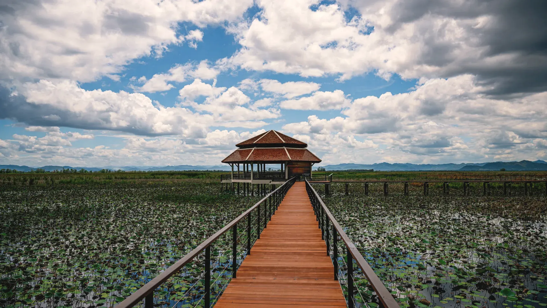
Chumphon is a long strip across the narrow part of the Malay Peninsula. The NSO report divides it into three zones: mountains and high ground in the west, a rolling and low-lying plain in the middle that is the main farming area, and a coastal plain on the east. The coast is about 222 kilometres long and fairly straight, with few bays, and the province averages about 36 kilometres wide.
The Tenasserim range is the natural border with Myanmar on the west. Short rivers run from those hills across the plain to the Gulf of Thailand: the report names the Tha Sae canal, the Tha Taphao River, the Lang Suan River and the Swi, Tako, Chumphon and Lamae canals. It lists forest at 803,290 rai, about 21.4 percent of the province, and limestone quarrying as the main mineral resource, with 961,512 metric tons produced in 2022.
Offshore, the Department of National Parks describes Mu Ko Chumphon National Park as a mix of coastline, mangrove, bays and 40 islands. It names four small coastal hills inside the park, the highest of them Khao Kratha at 300 metres. The same page says the Tung Ka–Swi Bay area, where more than ten canals flow in, has been registered as an internationally important wetland. The NSO report counts 44 islands in the province's waters, so island numbers differ by source and by what is counted.
Chumphon is humid with rain at some point in every month. The NSO report records 179 rain days and 2,694.8 millimetres of rain in 2022, an average maximum of 31.9 degrees Celsius and an average minimum of 24.0. It describes the hot season as not extreme and the cool season as only cool, not cold.
The Department of National Parks gives a longer-run picture. It says Chumphon sits on the peninsula between the Andaman Sea and the Gulf, so it catches both monsoons: the northeast monsoon from October to January and the southwest monsoon from mid-May to late September. It divides the year into a cool season from November to February, a hot season from February to May and a rainy season from May to November, with an average of about 173 rain days and 2,029.3 millimetres a year.
The two sources differ on rainfall because one is a single year and the other an average. For a would-be resident the practical point is that the south is wet for much of the year and that the heaviest weeks can interrupt boats to the islands. The figures here are not the Thai Meteorological Department's official 30-year normals, which we could not retrieve.
The NSO report says Chumphon's name appears in records from Buddhist Era 1098, and that it was a frontier town of Nakhon Si Thammarat with a goat as its town emblem, a city in the southern territory of Ayutthaya under King Borommatrailokkanat. These are traditional dates and should be read as the report's account, not an archaeological finding. In the reign of King Chulalongkorn (Rama V), Monthon Chumphon was created as an administrative circle; when the circles were abolished Chumphon became a province.
The report offers several guesses for the name and treats none as settled. One is chumnum phon, a gathering place for troops, because armies marching north or south camped here. Another is chumnum phon, a gathering to receive a blessing, from the pre-battle rites of old commanders. A third is that the original town stood by the Chumphon canal where a fig tree called ma-duea chumphon grew. The report also records that Wat Thep Charoen at the foot of Khao Rap Ro sits on the site of an ancient frontier town called Utumphon at the Malay isthmus, and that Wat Phra That Sawi is registered as a national monument.
Living culture is tied to the sea and to one prince. The memorial to Admiral Prince Abhakara Kiartivongse, known as Krom Luang Chumphon Khet Udomsak, who the report says modernised the Thai navy, is revered locally, and an annual fair and commemoration are held in December. Other annual events listed are the Lok Thale Chumphon sea fair in March, a sea-parting run to Ko Phithak in June, the Hae Phra boat-race festival in the Lang Suan basin in October and Long Kaeng Phato rapids season from January to February. The slogan quoted in the report mentions the gateway to the south, the prince, coffee farms, Hat Sai Ri, small finger bananas and edible bird's nests.
Chumphon's economy is led by agriculture, forestry and fishing. In the national accounts figures the NSO report quotes, the province's 2021 gross provincial product was 130,074 million baht, of which agriculture, forestry and fishing contributed 73,812 million. Wholesale, retail and vehicle repair came second at about 21,124 million baht. The per-person figure of 259,853 baht is the highest in the south, though the report does not say how much of it reflects a small population and large plantations.
Industry mostly processes what the land and sea produce. The report lists canned fruit and vegetables, palm-oil extraction, frozen seafood and fishmeal as the main industries. In 2022 it counts 490 factories with registered investment of 26,916.93 million baht and 14,784 workers. Fruit orchards, particularly rambutan, durian and mangosteen, support farm-visit tourism at places the report names, such as Suan Nai Dam in Thung Tako and Suan Thip in Mueang district.
Tourism is a secondary strand. The report lists coral diving at islands including Ko Ngam Yai and Ko Ngam Noi, a homestay on Ko Phithak in Lang Suan, and rapids rafting in Phato district. We opened the report's table of contents for tourism statistics but not the figures themselves, so we do not state visitor numbers or tourism revenue.
By road, the NSO report gives 498 kilometres from Bangkok along Highway 35 and then the Phetkasem road (Highway 4). The Department of National Parks says to allow 6 to 7 hours by car, through Nakhon Pathom, Samut Songkhram, Ratchaburi, Phetchaburi and Prachuap Khiri Khan, and to turn left at the Pathum Phon intersection for about 8 kilometres into town. Buses leave from Bangkok's southern bus terminal, and it advises checking times and reserving before you travel.
Chumphon is a stop on the southern railway. The NSO report puts the distance from Bangkok at about 476 kilometres, and says 26 passenger trains a day pass through, counting both directions, plus 5 freight trains. The Department of National Parks gives the journey as 8 to 9 hours depending on the type of train, from Bangkok or Thonburi stations.
For the sea, the park office at Hat Sai Ri is reached by provincial highway 4001 toward Pak Nam Chumphon, about 13 kilometres from town, then a right turn onto a rural road for about 9 kilometres and another kilometre to the gate, according to the Department of National Parks. The NSO report notes a domestic air transport table but we did not read it, so we do not say whether scheduled flights serve Chumphon today.
Marine national park
A national park of 198,125 rai covering coast, mangrove, rivers' mouths and 40 islands, with its office at Hat Sai Ri in Mueang district. The Department of National Parks lists snorkelling, scuba diving, kayaking, nature trails and camping, and says the Ko Ngam Yai and Ko Ngam Noi area often has whale sharks. It also records that the park's park lodging was listed as closed when we looked.
Memorial and shrine
The NSO report describes this memorial to Admiral Prince Abhakara Kiartivongse, who the report credits with modernising the Thai navy and who is revered by people in Chumphon. It includes the old shrine and the torpedo boat HTMS Chumphon, with the shrine on a nearby hill. A second shrine to him stands at Hat Arunothai in Thung Tako district.
Temple and registered monument
According to the NSO report, Wat Phra That Sawi in Sawi district houses relics in its chedi and is registered as a national monument. It is treated by local people as a sacred place and as an important historic site of the province. The report gives no founding date, so we give none.
Cave temple and ancient town site
The NSO report says Wat Thep Charoen at the foot of Khao Rap Ro stands where the ancient frontier town of Utumphon once sat, at the Malay isthmus, and is a registered national monument. The cave holds a principal Buddha image and 577 Buddha images in the subduing-Mara posture.
Water-management project and park
Located in Bang Luek subdistrict, Mueang district, this royal-initiative project uses the Nong Yai wetland as a natural flood-holding area, a monkey-cheek pond, to hold water against floods and store it for the dry season. The report says the province has developed the site as a visitor attraction and that it has a royal pavilion.
Beach
The NSO report describes this long, clean sandy beach in Pathio district, 16 kilometres from Chumphon town on a sealed road. Boats can be hired from here to Ko Ngam Yai and Ko Ngam Noi for snorkelling and diving. The report is the only source we opened, so we give no information about services or facilities on the beach.
Island fishing community
The report places this island village in Bang Nam Chuet subdistrict, Lang Suan district. It says the island was once uninhabited and used as a refuge from monsoon weather by fishermen, who gradually built permanent homes, and that villagers now run homestays where guests learn about local life and visit nearby islands.
Forest park and waterfall
The NSO report says this park of about 7,000 rai in Salui subdistrict, Tha Sae district, lies beside the Phetkasem road between kilometre markers 467 and 468, about 13 kilometres from Tha Sae. It has a small waterfall with a pool you can bathe in, planted forest and a range of plants, and the report suggests it for nature study.
The NSO report gives a picture of public services as of 2022. For schooling the 2022 school year had 285 schools, 4,686 teachers and 80,778 pupils, plus 9 vocational colleges and 2 higher-education institutions. For health, the report counts 1,159 hospital beds, 214 doctors, 59 dentists and 1,103 nurses. It lists post offices in every district and large communities, 15 in total.
Utilities are listed too. In fiscal year 2022 the province sold 985.8 million kilowatt-hours of electricity. The Provincial Waterworks Authority has three supply branches, at Chumphon, Tha Sae and Lang Suan, with 61,428 customers. Chumphon is a rail stop with 26 passenger trains a day in both directions, which matters if you plan to live here without a car.
What we cannot give you is cost of living, typical rents, broadband speeds, the quality of the hospitals, or the size of the foreign community. We found no official source for any of them, and the hospital count in the report was not clear enough for us to state. If you are thinking of living here, visit in more than one season, including the rainy months, and talk to people who already do.
BAANLYY does not run a rental hub or local listings for Chumphon, so this page is a reference guide and not a property search. Thai law limits what foreigners can own, and the rules for condominiums, leaseholds and company structures differ from one another, so read BAANLYY's ownership and visa guides and take advice from a qualified Thai lawyer before you commit money.
Much of the coast and the islands is national park, mangrove or registered wetland, and the Department of National Parks notes pressure from coconut plantations, resorts and restaurants on the beach forest behind the sand. That is a reason to check carefully what kind of land title any parcel has, and to confirm it with the local land office, before you pay a deposit.
Your visa route matters more than the province you choose. BAANLYY's visa guides cover the long-stay options in plain language and cite the official Thai sources for each. Nothing on this page is legal, tax or immigration advice, and BAANLYY is a property portal and is not a party to independent owners', agents' or agencies' leases or sales.
We left these out rather than guess. If you hold a current official source for any of them, tell us at hello@baanlyy.com.
The NSO provincial report gives about 6,010 square kilometres and 509,385 registered residents at the end of 2022 across eight districts.
About 498 kilometres by road along Highway 4 and about 476 kilometres by rail, according to the NSO. The Department of National Parks says allow 6 to 7 hours by car.
Yes. The NSO report says 26 passenger trains a day pass through Chumphon, counting both directions, and the Department of National Parks gives the journey as 8 to 9 hours from Bangkok.
It is a marine national park of 198,125 rai with 40 islands, known for coral, diving and snorkelling. Its office is at Hat Sai Ri, Mueang district, according to the Department of National Parks.
Humid and rainy. The NSO recorded 179 rain days and 2,694.8 millimetres in 2022, and the Department of National Parks gives a long-run average of 2,029.3 millimetres a year.
Mainly farming, forestry and fishing, which made up 73,812 million baht of the 130,074 million baht gross provincial product in 2021, plus food processing and some tourism.
Not yet. BAANLYY has no local listings or property managers in Chumphon, so this page is a reference guide. Check land title and access yourself, and take advice from a Thai lawyer.
Facts on this page were checked against the sources above on 2026-10-12. Official figures change; confirm current numbers and rules with the relevant authority before relying on them.
BAANLYY LLC is a Nevada property portal. Homes are listed by independent owners, agents and agencies; BAANLYY is not a party to their leases or sales. Owners who contact BAANLYY directly can have their home listed and managed by the BAANLYY founding team under a written agreement. General information, not legal, tax, immigration or financial advice.