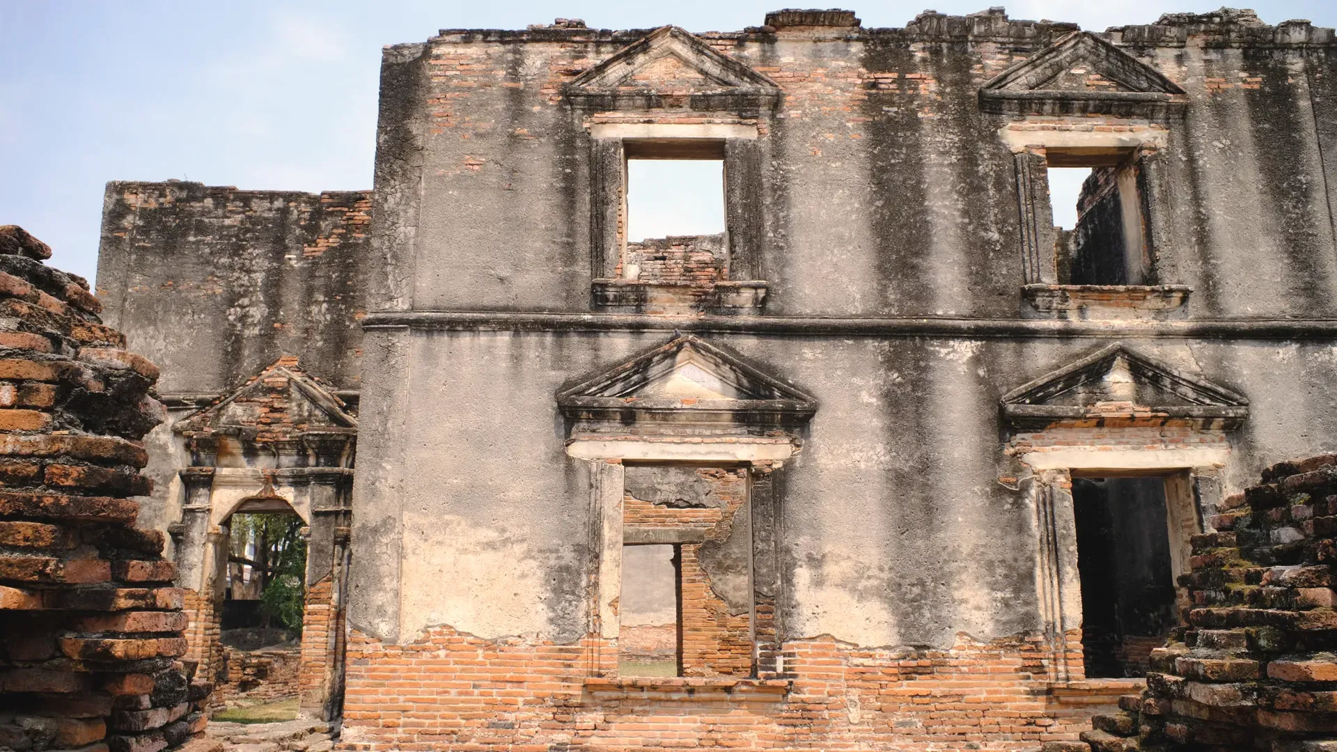
Lop Buri is a central-plains province about 153 km north of Bangkok, known for Khmer-era shrines, King Narai's palace, a big dam and farmland. Figures are from the provincial development plan, dated 2021.
CentralRegion
Mueang Lop BuriProvincial capital
ลพบุรีThai name
Registered population
Lop Buri had 718,228 people in the civil registration system in August 2026 (716,776 Thai nationals and 1,452 registered non-Thai nationals), according to the Department of Provincial Administration. That is the 35th largest registered population of Thailand's 77 provinces and about 1.1 percent of the national registered total of 65,677,170.
This is the number of people entered in the house registration system for the province, not a count of everyone who lives there. People who work in another province often stay registered at home, and most foreigners on short stays are not in the registry at all. Official table for August 2026 (read by BAANLYY on 14 November 2026) · Compare all 77 provinces
About Lop Buri
Lop Buri sits in central Thailand on the left bank of the Lop Buri River, 153 kilometres north of Bangkok by the Phahonyothin road and about 133 kilometres by rail, according to the provincial development plan for 2023 to 2027. It covers about 6,200 square kilometres, split between a flat river plain in the west and low hills and mountains in the east. Most of the land is farmed.
The plan counted 740,487 registered residents in August 2021 across eleven districts, and a provincial briefing gave 739,088 in July 2022. The town of Lop Buri is the draw for visitors: a seventeenth-century royal palace, three Khmer-style towers beside the railway, and an old Khmer shrine. Out in the districts are a very long earth dam, a mountain stairway, a wildlife sanctuary and the sugarcane, cassava and maize fields that feed the local economy.
Be clear about what this page rests on. We could not open the National Statistical Office's 2025 provincial report for Lop Buri, so most figures come from the provincial development plan and carry 2019 to 2021 dates. They are labelled with their years. BAANLYY does not yet have local listings, partnered landlords or property managers in Lop Buri, so treat this page as a reference guide and check everything on the ground.
Lop Buri at a glance
Region
Central Thailand, on the left bank of the Lop Buri River source
Area
About 6,199.77 square kilometres (about 4,063,169 rai), provincial development plan 2023-2027 source
Registered population, August 2021
740,487 people (369,278 men and 371,209 women) in 302,176 households, about 2.55 people per household, from the Department of Provincial Administration as quoted in the plan source
Registered population, July 2022
739,088 people (369,276 men and 369,812 women) in 305,060 households, from the provincial briefing source
Administrative divisions, 2021
11 districts, 121 sub-districts and 1,122 villages; one provincial administrative organisation, 23 municipalities and 102 sub-district administrative organisations source
Distance from Bangkok
153 kilometres by road along the Phahonyothin route; about 133 kilometres by rail source
Gross provincial product, 2019
About 110,825 million baht, or 142,776 baht per person; the plan prints 110,824 in one table and 110,825 in another source
Land use
2,873,256 rai of farmland (70.71 percent of the province) and 1,110,108 rai (27.32 percent) of national reserve forest, as stated in the plan source
Roads, 2021
2,116.985 kilometres of highway and rural-road network and 402 bridges, under the Highways Department and Rural Roads Department districts named in the plan source
Where Lop Buri sits
The development plan splits Lop Buri into two landscapes. About 70 percent is plain broken by hills and mountains, in the east of Mueang Lop Buri, parts of Ban Mi and Khok Samrong, and almost all of Sa Bot, Khok Charoen, Tha Luang, Chai Badan and Phatthana Nikhom. The other 30 percent is low floodplain, covering Tha Wung, the west of Mueang Lop Buri and parts of Ban Mi and Khok Samrong.
Ground height tells you which land is which. The river floodplain sits only 2 to 20 metres above sea level and is mostly rice. The Pa Sak River's narrow lowland, running through Chai Badan and Phatthana Nikhom, is about 25 to 60 metres up. The mountains rise to between 100 and 750 metres and are mostly not farmed. The plan says Lop Buri borders Phetchabun and Nakhon Sawan to the north, Saraburi and Ayutthaya to the south, Chaiyaphum and Nakhon Ratchasima to the east, and Sing Buri, Ang Thong and Nakhon Sawan to the west.
Four national reserve forests cover 1,776.17 square kilometres, nearly 29 percent of the province, in the plan's table: Chai Badan, Sub Lanka, a combined Wang Phloeng, Muang Khom and Lam Narai forest, and Khao Phaniat. Farmland takes 2,873,256 rai, of which 917,925 rai is rice paddy and 1,811,855 rai is field crops. The plan notes 112,294 rai in a self-help settlement area overlaps military land.
Climate and the seasons
Lop Buri is hot and humid, shaped by two monsoons. The plan says the northeast monsoon brings the cool season and the southwest monsoon brings the rains, with the heaviest rain from August to September. It names two weather stations, at Lop Buri and at Utok Bua Chum.
The plan prints a table for the Lop Buri station for 2016 to 2021. For 2021 it gives a highest monthly average of 34.7 degrees Celsius in April and a lowest of 25.7 degrees in December. Rainfall swings widely from year to year in the same table, from 449.4 millimetres in 2020 to 1,283.0 millimetres in 2018, so one year is a poor guide. We did not find official long-term climate normals, so we give none.
History and culture
People have lived here for a long time. The plan describes the Ban Pong Manao museum, about 26.5 kilometres from the Pa Sak Jolasid Dam, as the site of a prehistoric settlement some 2,500 to 3,000 years old, where 13 human skeletons were dug up. Khmer-built shrines in the town, among them San Phra Kan and the three towers of Phra Prang Sam Yot, show later centuries of settlement.
The plan dates the royal palace to 1666 (BE 2209), when King Narai ordered a residence built at Lop Buri. King Mongkut had it restored in 1856 (BE 2399) and gave it the name Phra Narai Ratchaniwet. The plan calls it the best-preserved ancient palace in Thailand. An annual festival, the King Narai Reign Fair, decorates the palace and nearby sites such as Ban Wichayen.
Lop Buri is also a mix of peoples. The plan names at least five groups: central Thai, Thai Beung, Mon, Lao Phuan and Chinese. The Thai Beung of Khok Salung are said to have lived in their settlement for at least 260 years. The Phuan village of Ban Sai moved from Xieng Khouang in Laos in 1856 and holds a farming festival around February. The Mon of Bang Khan Mak, two or three kilometres west of town, still wear a traditional shoulder cloth in temple ceremonies.
How people earn a living here
The plan gives Lop Buri's gross provincial product as about 110,825 million baht in 2019, or 142,776 baht a head, up from 66,043 million baht in 2009. These are old figures, and we did not find the current NESDC ranking, so we cannot say how the province compares today.
The land use figures show the base: farming. The Provincial Agriculture Office's table for 2021 lists about 766,000 rai of main-season rice, 365,581 rai of sugarcane, 301,782 rai of cassava and 423,389 rai of animal-feed maize. The plan also lists processing factories, including plastics, metal, chemicals and plant-product plants, and names mineral resources such as limestone, marble and perlite in the forest areas.
Visitors and festivals are a smaller part of the picture than farming. The plan's own goals centre on safe farm produce and new-style tourism. We did not open its tourism income table, so we give no visitor numbers.
Getting to Lop Buri
The plan puts Lop Buri 153 kilometres north of Bangkok by the Phahonyothin road and about 133 kilometres by railway. The railway line runs right through the old town, between San Phra Kan and Phra Prang Sam Yot, so the main sights are beside the tracks. Within the province, the plan counts 2,116.985 kilometres of road and 402 bridges as of 2021.
We did not find an official source this run for bus timetables, train frequency, journey times or the nearest commercial airport, so we list none. Outside the town, the dam, mountain stairway and sanctuary are far apart across eleven districts, so most visitors will want a car or motorbike.
Places worth knowing in Lop Buri
Phra Narai Ratchaniwet (พระนารายณ์ราชนิเวศน์)
Royal palace and national museum
King Narai had this palace built in 1666 as his residence in Lop Buri. The plan describes outer, middle and inner royal zones, brick walls topped with crenellations, 11 gates and about 2,000 small lamp niches. King Mongkut restored it in 1856 and named it.
Three towers joined by covered walkways, built of laterite in the Khmer Bayon style and dated by the plan to about the 18th Buddhist century. It was probably a Mahayana shrine, later Hindu, and was turned into a Buddhist temple under King Narai. The front shrine dates from 1951.
A laterite shrine on a tall base just east of the railway, next to Phra Prang Sam Yot, once known as the high shrine. The plan describes a sandstone lintel carved with Vishnu reclining, dated to about the 16th Buddhist century, and notes an eight-sided inscribed stone found here.
The plan says the dam, opened officially on 25 November 1999 under a royal-initiative Pa Sak basin project, is 4,860 metres long and 36.5 metres at its highest, with a capacity of 765 million cubic metres. It calls it the longest clay-core dam in Thailand.
A temple sits at the foot of this 600-metre peak. The plan says a stairway of 3,790 steps, 1,680 metres long, leads to a replica footprint at the top, about two hours' walk, through forest and bamboo. The mountain features in local tales of Thao Kok Khanak and King Kong Chin.
Sub Lanka Wildlife Sanctuary (เขตรักษาพันธุ์สัตว์ป่าซับลังกา)
Wildlife sanctuary
The plan gives the sanctuary about 96,875 rai at Ban Lanka, linking Lam Sonthi and Kut Ta Phet sub-districts, a valley plain 140 to 846 metres above sea level ringed by the Phang Hoei range. It is the headwater forest of the Lam Sonthi River and still shelters the protected serow.
In Huai Khun Ram sub-district, about 26.5 kilometres from the Pa Sak Jolasid Dam. The plan says it displays a prehistoric human site about 2,500 to 3,000 years old, comparable to the late Ban Chiang period, where 13 ancient skeletons were excavated.
What the plan documents is basic infrastructure. In 2021 it counted 276,198 households with electricity, 1,607 using solar power and 633 without power. The Provincial Waterworks Authority had 84,700 customers, with production capacity of 102,654 cubic metres a day. Of the 740,487 residents, 736,253 were Buddhist, 3,071 Muslim and 1,163 Christian, with 451 temples, 12 churches and 7 mosques.
What we cannot tell you is the cost of living, typical rents, internet speed, hospital capacity or how many foreign residents live here, because we found no official source for any of them this run. The NSO site lists indicators such as household internet access, but we did not open them. Visit in more than one season and talk to residents before you decide anything.
Renting, buying and visas
BAANLYY does not yet have local listings, partnered landlords or property managers in Lop Buri, so this page is a reference guide and not a property search. Thai law limits what foreigners can own, and the rules for condominiums, leaseholds and company structures differ from one another, so read BAANLYY's ownership and visa guides and take advice from a qualified Thai lawyer before you commit money.
Your visa route matters more than the province you choose. BAANLYY's visa guides cover the long-stay options in plain language and cite the official Thai sources for each. Nothing on this page is legal, tax or immigration advice, and BAANLYY is a property portal and is not a party to independent owners', agents' or agencies' leases or sales.
What we could not confirm
We left these out rather than guess. If you hold a current official source for any of them, tell us at hello@baanlyy.com.
The NSO Lop Buri Provincial Statistical Report 2025. The NSO provincial page did not expose its file, so most figures here are 2019 to 2021 figures from the provincial plan.
Hospitals, doctors and bed counts. The plan pages we opened did not include the health tables.
Cost of living, typical rents and house prices. We found no official source.
The number and make-up of foreign residents in Lop Buri.
Bus, rail and air connections, including train frequency, journey times and the nearest airport.
Official long-term climate normals from the Thai Meteorological Department. We give only the plan's 2016 to 2021 table, which extracted unevenly.
Sunflower area. The plan's text says 200,000 to 300,000 rai, but its 2021 crop table gives 6,355 rai, so we give the table figure and no more.
Map coordinates for the capital and the places listed. We found no source that names each place with its district, so no map is drawn.
Fine Arts Department registration details for the shrines and palace, and visiting hours or fees. We did not open those pages.
FAQ
Questions about Lop Buri
How far is Lop Buri from Bangkok?
The provincial development plan gives 153 kilometres by road along the Phahonyothin route and about 133 kilometres by railway.
How big is Lop Buri province?
The plan gives about 6,199.77 square kilometres, or roughly 4,063,169 rai, spread across eleven districts.
How many people live in Lop Buri?
The plan lists 740,487 registered residents in August 2021 and the provincial briefing lists 739,088 in July 2022. The registered population section on this page gives the official registry figure for a later month.
What is the oldest thing to see in Lop Buri town?
San Phra Kan and Phra Prang Sam Yot are Khmer-era shrines beside the railway, and the plan dates them to the 16th and 18th Buddhist centuries respectively.
Who built Phra Narai Ratchaniwet?
The provincial plan says King Narai ordered the palace built in 1666 as his residence in Lop Buri, and that King Mongkut restored it in 1856.
Does BAANLYY have rental listings in Lop Buri?
Not yet. BAANLYY has no confirmed local listings, landlords or property managers in Lop Buri, so check rents, contracts and neighbourhoods on the ground before committing.
What does Lop Buri grow?
The plan's 2021 table lists main-season rice, sugarcane, cassava, animal-feed maize and a small area of sunflower, with farmland covering about 71 percent of the province.
Facts on this page were checked against the sources above on 2026-10-12. Official figures change; confirm current numbers and rules with the relevant authority before relying on them.
BAANLYY LLC is a Nevada property portal. Homes are listed by independent owners, agents and agencies; BAANLYY is not a party to their leases or sales. Owners who contact BAANLYY directly can have their home listed and managed by the BAANLYY founding team under a written agreement. General information, not legal, tax, immigration or financial advice.