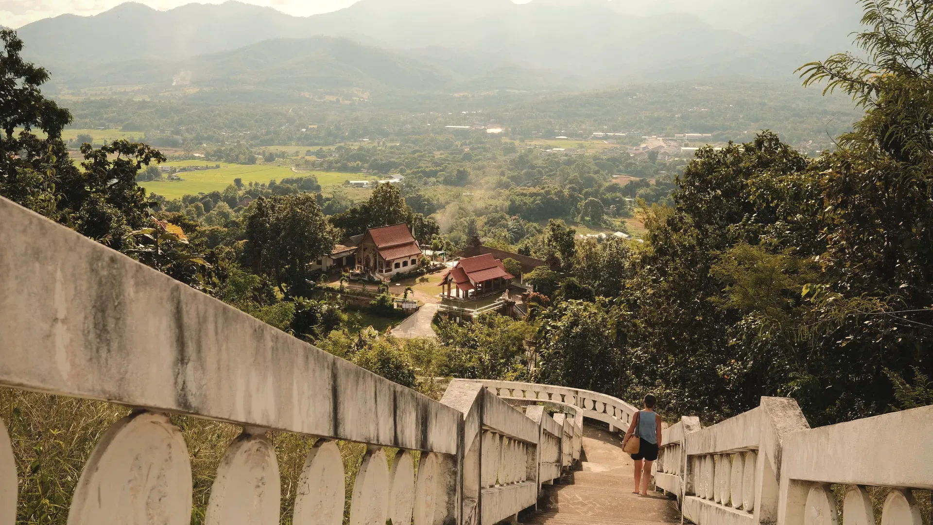
Mae Hong Son is a mountain province on the Myanmar border in the far west of northern Thailand, with Shan temples, Tham Lod cave and Mae Surin falls. Every fact here comes from Thai government sources.
NorthRegion
Mueang Mae Hong SonProvincial capital
แม่ฮ่องสอนThai name
Registered population
Mae Hong Son had 288,807 people in the civil registration system in August 2026 (243,195 Thai nationals and 45,612 registered non-Thai nationals), according to the Department of Provincial Administration. That is the 70th largest registered population of Thailand's 77 provinces and about 0.4 percent of the national registered total of 65,677,170.
This is the number of people entered in the house registration system for the province, not a count of everyone who lives there. People who work in another province often stay registered at home, and most foreigners on short stays are not in the registry at all. Official table for August 2026 (read by BAANLYY on 14 November 2026) · Compare all 77 provinces
About Mae Hong Son
Mae Hong Son sits against the Myanmar border at the western edge of Thailand's northern region. The National Statistical Office's 2024 provincial report puts it 928 kilometres from Bangkok, with Shan State to the north, Myanmar to the west, Chiang Mai province to the east and the Tha Song Yang district of Tak to the south. It is mostly forested mountain. The same report says forest covers about 90.5 percent of the province, roughly 11,476.5 square kilometres.
It is also one of the least crowded places in the country. The registry figure the NSO quotes for 2021 is 285,916 people, which works out at 23.35 people per square kilometre. Only about 7 percent of residents live inside municipal areas, so outside the town of Mae Hong Son, Pai, Mae Sariang and a few other district centres you are in villages, farms and forest. If you are weighing a move, that is the first thing to understand: this is a province where distance and terrain shape daily life.
The people are mixed. The provincial record describes Shan (Tai Yai) communities on the plains and Karen, Lahu, Lisu, Hmong and other hill peoples higher up, and the Shan influence is easy to see in the temples of the provincial town. Visitors come for temples, caves, hot springs, waterfalls and the cool, misty mornings. Retirees and remote workers should know that BAANLYY has no local listings, no confirmed landlords and no property managers here yet, so this page is a reference guide and not a property search.
Mae Hong Son at a glance
Region
Western edge of northern Thailand, on the Myanmar border source
Distance from Bangkok
928 kilometres, according to the NSO 2024 provincial report source
Administrative divisions
7 districts, 45 subdistricts and 415 villages (2021) source
Registered population
285,916 people in 2021 (144,811 men and 141,105 women), from the Department of Provincial Administration as quoted by the NSO. Density 23.35 people per square kilometre. source
Forest cover
About 90.5 percent of the province, roughly 11,476.5 square kilometres. National reserved forest alone is about 7,042,311 rai, or 88.85 percent. source
Highest peak
Mae Ya, about 2,005 metres above sea level, in Pai district source
Gross provincial product
15,148 million baht in 2020, or 63,419 baht per person (NESDC figures quoted by NSO) source
Weather in 2021
Average lowest temperature 18.2 degrees C and average highest 36.5 degrees C; 144 rainy days and about 1,092 millimetres of rain source
Hospitals
7 hospitals in fiscal year 2021, one in every district, with 81 doctors, 503 nurses and 420 beds source
Schools
328 schools, 2,629 teachers and 44,103 pupils in the 2021 school year source
Where Mae Hong Son sits
Most of the province is a tangle of steep ridges running north to south. The NSO report names the Dan Lao range along the northern edge, which marks the border with Myanmar, and the Thanon Thong Chai range, which runs in three parallel lines. The western line forms the Thai-Myanmar boundary, and the eastern line separates Mae Hong Son from Chiang Mai. The highest point, Mae Ya, rises to about 2,005 metres in the eastern range in Pai district.
Three rivers matter. The Pai rises in the Thanon Thong Chai range and runs 135 kilometres through the province before it joins the Salween in Myanmar. The Yuam rises east of Khun Yuam, flows 160 kilometres past Mae La Noi and Mae Sariang and meets the Moei on its way into Tak. The Samat rises on Doi Mae Samat and drains through Mueang district into the Pai. The report measures the province at about 250 kilometres from north to south and 95 kilometres across.
Climate and the seasons
The NSO report describes a climate shaped by the mountains. Mist hangs over the valleys for much of the year, winters are cold and summers are hot. For 2021 it records an average lowest temperature of 18.2 degrees C and an average highest of 36.5 degrees C, relative humidity between 54.03 and 90.74 percent, and 144 rainy days that delivered about 1,092 millimetres of rain.
The report's tourism entries add seasonal detail. Pha Suea waterfall carries water all year but is fullest from July to September. The Bua Tong, a yellow wild sunflower, blankets the slopes of Doi Mae U-Kho from November into early December. Those are single-year and descriptive figures, not long-run climate normals, so treat them as a guide and check the Thai Meteorological Department before you plan around a particular month.
History and culture
The report's own account starts with elephants. Around 1831 (BE 2374), it says, the ruler of Chiang Mai sent Chao Kaeo Mueang Ma to survey the western frontier and catch wild elephants. He found a small village by a salt lick, named Ban Pong Mu (later Pang Mu), and then a stream channel suited to training elephants. The name Mae Hong Son is said to come from that channel, and the elephant at play is still the province's emblem. Read this as the recorded tradition, not as a dated fact.
More Shan people crossed the border after fighting in Myanmar in 1856. One of them, Chan Kale, was named Phraya Singhanat Racha in 1874 and governed the town as its first ruler. The report says King Rama V merged the towns of Mae Hong Son, Khun Yuam, Mae Sariang and Pai in 1900, set up a town hall in 1910, and that Mae Hong Son became a province in the reign of King Rama VI, coming under the Ministry of Interior in 1933.
The Shan legacy is the cultural centrepiece. Wat Phra That Doi Kong Mu holds two chedis on the hill above town, the larger said to have been built in 1860 and the smaller in 1874. Wat Chong Kham has a roof in the form of a prasat and a large Buddha built by Burmese craftsmen in 1934, and the carved wooden figures at the neighbouring temple were, the report says, brought from Myanmar around 1857.
How people earn a living here
Farming is the main occupation, according to the NSO report. The field crops it lists are maize for animal feed, soybeans, peanuts and red kidney beans, with garlic, cabbage and pumpkin the main vegetables. Forest is the other big resource, and the report records that tea is grown at higher altitudes around the Pang Tong royal residence area.
The province produced 15,148 million baht of gross provincial product in 2020, or 63,419 baht per person, according to NESDC figures quoted by the NSO. That is a small economy by national standards, and the report gives no breakdown for tourism. For anyone thinking about work, plan on remote income, a pension, or a small business tied to the farm and visitor economy rather than a large local job market.
Getting to Mae Hong Son
The NSO report lists two ways in, road and air. On the road, Highway 108 runs from Mae Hong Son through Mae Sariang and Hot to Chiang Mai, about 350 kilometres with 1,864 curves, and the report puts the journey at 8 to 9 hours. Highway 1095 runs through Pai and Mae Taeng, about 245 kilometres, and the report gives 5 to 6 hours. It also lists air-conditioned vans on the Pai route and a Bangkok coach service.
The report names Nok Air as the carrier on the Mae Hong Son to Bangkok flight, on Mondays, Wednesdays, Fridays and Sundays. That schedule comes from a report built on 2021 data, so it is not a current timetable; check with the airline before you plan around it. On the road, expect the mountain curves to slow you down more than the distance suggests.
On 12 October 2026, the UK Foreign Office's Thailand advice page listed areas of the south and the Cambodia border under its advisory, and did not name Mae Hong Son. Other governments publish their own advice, so check yours before you travel near the Myanmar border.
Places worth knowing in Mae Hong Son
Wat Phra That Doi Kong Mu (วัดพระธาตุดอยกองมู)
Temple and viewpoint
Shan-style temple on Doi Kong Mu, west of the town, with two chedis. The NSO report says the larger was built by Chong Tong Su in 1860 and the smaller by Phraya Singhanat Racha in 1874. A paved road of about 2 kilometres climbs to it and the view takes in the town.
Shan-style temple beside the lake in the town. The report dates it to 1797 and describes a roof shaped like a prasat. It houses a large Buddha image, 4.85 metres across the lap, built in 1934 by Burmese craftsmen. The date given for the temple is older than the report's own account of the town's settlement.
Temple at the foot of Doi Kong Mu with a Shan-style reclining Buddha 12 metres long. Tradition holds that Nang Mia, the wife of Phraya Singhanat Racha, had it built. Two large lion statues stand beside the path up to the hilltop chedis, one credited to her and one to her husband.
Tham Lod Nature Education Centre and Wildlife Sanctuary (สถานศึกษาธรรมชาติและสัตว์ป่าถ้ำน้ำลอด)
Cave and archaeological site
Archaeological cave system in Pang Mapha district, about 77 kilometres from Mae Hong Son town on Highway 1095. A stream runs through the mountain, and tools found inside are thought to be about 2,000 years old. The report describes three large chambers and the Phi Man cave with wooden coffins, and says you need a guide with a lantern.
Mae Surin Waterfall National Park (อุทยานแห่งชาติน้ำตกแม่สุรินทร์)
National park
National park of 247,875 rai across Khun Yuam and Mueang districts, declared on 29 October 1999. The waterfall drops from a cliff of about 100 metres, reached by Highway 108 to Khun Yuam and then roughly 50 kilometres further. The report notes park accommodation and camping.
Bua Tong fields at Doi Mae U-Kho (ทุ่งบัวตองดอยแม่อูคอ)
Seasonal flower field
Highland slope of about 1,000 rai near Ban Mae Surin in Khun Yuam district, in a royal highland forestry project area. The yellow Bua Tong flowers bloom from November into early December, and the report calls it the main time to visit. Mae U-Kho waterfall, about 30 metres high, is close by.
Temple in Pai district, about 3 kilometres west of the town, that holds a revered bronze Buddha the report puts at roughly 500 years old. Water collects in the open top of the image's head, which draws pilgrims. A memorial chedi to Princess Suphankanlaya, sister of King Naresuan, stands in the grounds.
The documented basics are present but thin, and they are older than you would like. In fiscal year 2021 the province had seven hospitals, one in every district, with 81 doctors, 503 nurses and 420 beds. Together they dealt with 386,214 patients, of whom 31,007 were inpatients. For schooling, the 2021 school year counted 328 schools with 2,629 teachers and 44,103 pupils.
Utilities are listed too. In 2021 there were five provincial waterworks that produced 5,041,962 cubic metres of water for 15,031 users, and 151.57 million kilowatt-hours of electricity were sold inside the province. What we could not find from an official source is a cost-of-living figure, typical rents, internet speeds or the size of the foreign community. If you are thinking of living here, visit in more than one season, see the nearest hospital for yourself, and talk to people who already do.
Renting, buying and visas
BAANLYY does not run a rental hub or local listings for Mae Hong Son, so this page is a reference guide and not a property search. Thai law limits what foreigners can own, and the rules for condominiums, leaseholds and company structures differ from one another. Read BAANLYY's ownership guides and take advice from a qualified Thai lawyer before you commit money, and be especially careful with rural land, where options for foreign buyers are narrow.
Your visa route matters more than the province you choose. BAANLYY's visa guides cover the long-stay options in plain language and cite the official Thai sources for each. Nothing on this page is legal, tax or immigration advice, and BAANLYY is a property portal and is not a party to independent owners', agents' or agencies' leases or sales.
What we could not confirm
We left these out rather than guess. If you hold a current official source for any of them, tell us at hello@baanlyy.com.
The province's total area. The NSO report gives forest area and a population density but no total in the pages we read.
Distance from Bangkok and village count. The Ministry of Commerce provincial page says about 924 kilometres and 402 villages against the NSO's 928 kilometres and 415 villages, but that page appears to be copied from Wikipedia, so we used the NSO figures.
Current flights and bus timetables. The report's schedule reflects 2021 data.
Official 30-year climate normals from the Thai Meteorological Department. The figures here are single-year readings from 2021.
Cost of living, typical rents and house prices. We found no official source.
The size and make-up of the foreign community in Mae Hong Son.
Tourism numbers and the share of the economy that comes from visitors.
The construction date of Wat Chong Kham. The report says 1797, which is earlier than its own account of the town's settlement, and we could not resolve it.
Travel advice from governments other than the UK, and any border-area restrictions along the Myanmar frontier.
Map coordinates for the capital and the places listed. We did not find a government source that names each place and district, so no map is drawn on this page.
FAQ
Questions about Mae Hong Son
How far is Mae Hong Son from Bangkok?
The National Statistical Office's 2024 provincial report gives 928 kilometres by road. Official sources do not all agree on the exact figure, and the road distance depends on which route you take through Chiang Mai.
How many people live in Mae Hong Son?
The NSO report quotes a registered population of 285,916 for 2021, about 23 people per square kilometre. The registered population section on this page gives the official registry figure for a later month.
Is Mae Hong Son mostly forest?
Yes. The NSO report says forest covers about 90.5 percent of the province, roughly 11,476.5 square kilometres, and that national reserved forest alone is about 88.85 percent.
How do you get to Mae Hong Son by road?
The report lists Highway 108 through Mae Sariang, about 350 kilometres and 8 to 9 hours, and Highway 1095 through Pai, about 245 kilometres and 5 to 6 hours, both starting from Chiang Mai.
When do the Bua Tong flowers bloom at Doi Mae U-Kho?
The NSO report says the yellow Bua Tong bloom from November into early December on the slopes near Ban Mae Surin in Khun Yuam district, across roughly 1,000 rai.
Does BAANLYY have rental listings in Mae Hong Son?
No. BAANLYY has no local rental hub, listings or property managers in Mae Hong Son yet, so use this page for orientation and check any property independently.
What is the history behind the name Mae Hong Son?
The report says the name comes from a stream channel where wild elephants were trained, around 1831. Treat that as the recorded tradition rather than a dated fact.
Facts on this page were checked against the sources above on 2026-10-12. Official figures change; confirm current numbers and rules with the relevant authority before relying on them.
BAANLYY LLC is a Nevada property portal. Homes are listed by independent owners, agents and agencies; BAANLYY is not a party to their leases or sales. Owners who contact BAANLYY directly can have their home listed and managed by the BAANLYY founding team under a written agreement. General information, not legal, tax, immigration or financial advice.