Thailand · North · Phitsanulok
Phitsanulok (พิษณุโลก)
Phitsanulok is the main city of lower northern Thailand, home of the Phra Phutthachinnarat Buddha at Wat Yai, with national parks to the east. Every fact here comes from Thai government sources.
Phitsanulok is the main city of lower northern Thailand, home of the Phra Phutthachinnarat Buddha at Wat Yai, with national parks to the east. Every fact here comes from Thai government sources.
Phitsanulok had 832,592 people in the civil registration system in August 2026 (830,652 Thai nationals and 1,940 registered non-Thai nationals), according to the Department of Provincial Administration. That is the 28th largest registered population of Thailand's 77 provinces and about 1.3 percent of the national registered total of 65,677,170.
This is the number of people entered in the house registration system for the province, not a count of everyone who lives there. People who work in another province often stay registered at home, and most foreigners on short stays are not in the registry at all. Official table for August 2026 (read by BAANLYY on 14 November 2026) · Compare all 77 provinces
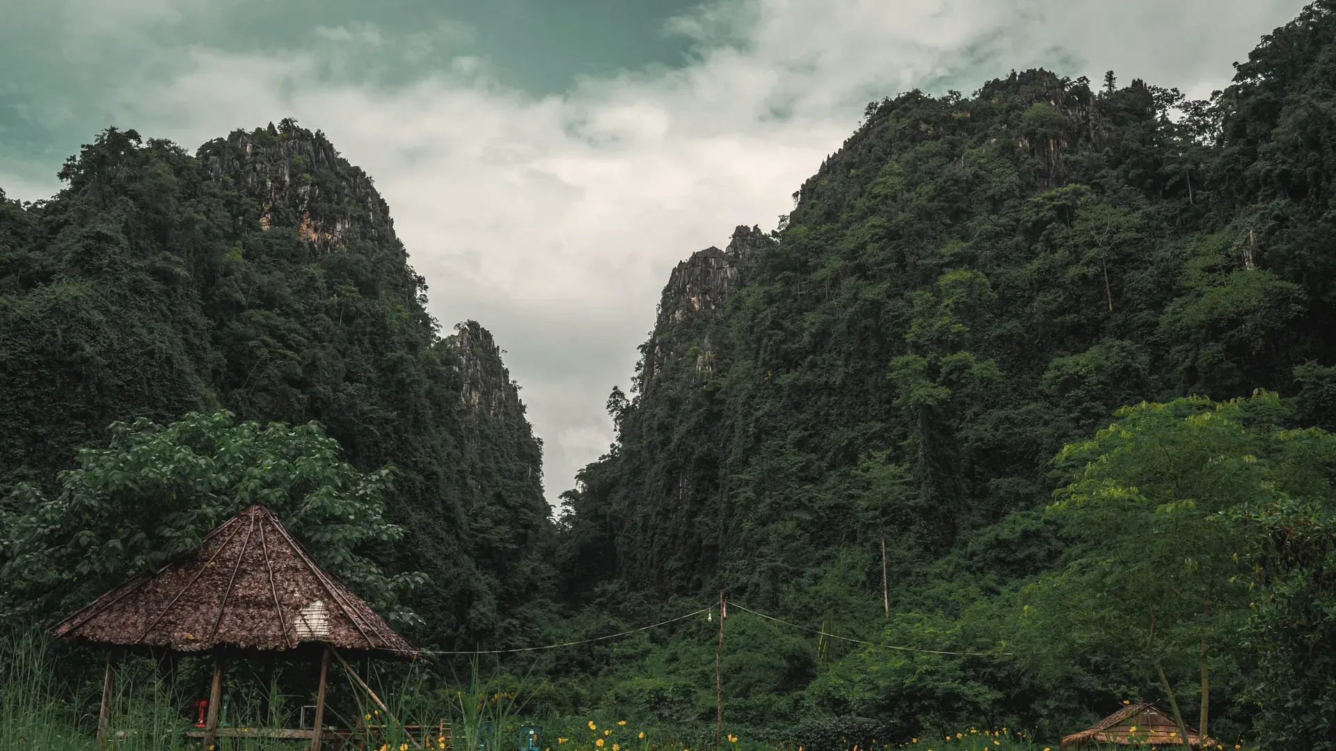
Phitsanulok is a lower northern province about 377 kilometres from Bangkok by road, according to the Ministry of Commerce provincial office. It covers 10,815.8 square kilometres, which the same page says is 2.1 percent of the country. The provincial town sits on both banks of the Nan River, and the province runs from flat rice plains in the south up into forested mountains along the borders with Loei, Phetchabun and Laos.
The National Statistical Office's provincial office puts the 2022 population at 844,494. It fits the role the Ministry of Agriculture's provincial paper gives the city: the government named Phitsanulok the main city for trade development in the lower northern group of provinces, a plan it ties to a Cabinet resolution of 29 July 1997 that described the area as an Indochina crossroads.
For visitors, the centre of gravity is Wat Phra Si Rattana Mahathat, known as Wat Yai, which holds the Phra Phutthachinnarat Buddha image. Further out are national parks, notably Thung Salaeng Luang, Phu Hin Rong Kla and Chat Trakan, plus rapids on the Khek River and an old stupa on Khao Samo Khlaeng. The province also has a long history as a royal city, which is covered below.
If you are weighing a move or a long stay, read this page as a map of what is documented and what is not. We could confirm the area, distance, rainfall, farming, the main heritage sites and the parks. We could not confirm hospital numbers, rents, the size of any foreign community, temperatures or flight options, and the list at the end of this page says so. BAANLYY does not have local listings in Phitsanulok.
| Region | Lower northern Thailand, bordering Uttaradit, Phetchabun, Phichit, Kamphaeng Phet, Sukhothai and Loei provinces and, to the north, the Xaignabouli region of Laos source |
|---|---|
| Area | 10,815.8 square kilometres, or 6,759,909 rai, which the Ministry of Commerce page gives as 6.4 percent of the northern region and 2.1 percent of Thailand source |
| Distance from Bangkok | About 377 kilometres by road, stated by both the Ministry of Commerce provincial office and the Ministry of Agriculture's provincial paper source |
| Population | 844,494 people in 2022, from the Phitsanulok Provincial Statistical Office's key indicators page source |
| Districts | Nine: Mueang Phitsanulok, Phrom Phiram, Bang Krathum, Noen Maprang, Nakhon Thai, Chat Trakan, Bang Rakam, Wang Thong and Wat Bot source |
| Rainfall | Averages about 1,100 to 1,300 millimetres a year; 1,256.6 millimetres in 2021 and 1,620.8 millimetres in the wettest of the ten years to 2021 (2017) source |
| Main rivers | Four: the Nan, the Khwae Noi, the Wang Thong and the Yom. The Ministry of Agriculture paper also counts 355 natural streams and canals and 157 natural swamps and ponds. source |
| Wat Phra Si Rattana Mahathat | Registered by the Fine Arts Department as a national ancient monument in the Royal Gazette of 27 September 1936 (BE 2479); the boundary of about 15 rai 3 ngan 83 square wah was announced on 14 February 1989 (BE 2532) source |
Phitsanulok is a province of two halves. The Ministry of Commerce page says the north, the east and part of the middle are mountains and plateau, with high ground on the eastern and north-eastern side in Wang Thong, Wat Bot, Chat Trakan and Noen Maprang districts. The south and south-west are plains, and the far south is low floodplain, especially along the Nan and Yom rivers.
Two upland valleys stand out. The Nakhon Thai valley is a fertile silt plain shaped like a bowl, and the Chat Trakan valley is crescent-shaped and equally fertile. The high peaks listed on the page include Khao Chong Lom, Khao Umong, Khao Khan Chong, Khao Samo Khraeng and Khao Fa, and the ranges along the east join up with those in southern Uttaradit and run south to the Phetchabun and Loei borders.
The Ministry of Agriculture's provincial paper says the lowland districts of Mueang, Phrom Phiram, Bang Krathum and Bang Rakam are the main rice-growing area and earn most of the province's farm income. It adds that Bang Rakam, near the Yom basin, floods every year, so that people cannot grow crops or raise animals there. The district takes on the rainy-season water and is a source of wild and farmed freshwater fish.
On land use, the same paper breaks down a soil survey of 6,622,820 rai: 39.15 percent is dry upland soil, 34.78 percent steep slope and 23.23 percent lowland. Its measure of total area differs slightly from the Ministry of Commerce's 6,759,909 rai, so treat the two as different surveys, not a contradiction.
The Ministry of Agriculture paper describes three seasons. The hot season runs from about mid-February to mid-May, with April the hottest month. The rainy season runs from about May to mid-October, when the south-west monsoon covers Thailand, and August is the wettest month. The cool season runs from about mid-October to mid-February, with December and January the coldest months.
Rainfall records for the Phitsanulok meteorological station, quoted in the paper, show an average of roughly 1,100 to 1,300 millimetres a year, with real variation. For the ten years from 2012 to 2021 the annual totals were 1,251.8, 1,468.9, 1,329.4, 893.8, 1,380.8, 1,620.8, 1,189.1, 1,317.0, 1,148.3 and 1,256.6 millimetres. The wettest year was 2017 and the driest was 2015, when only 893.8 millimetres fell.
The temperature table in the source we opened did not read cleanly, so we do not quote temperatures. We did not find official 30-year normals from the Thai Meteorological Department, and that is listed as unconfirmed below. The mountains in the east will run cooler than the valley floor, and the low south is where floods are a concern.
The Ministry of Commerce page says evidence of a city on the site goes back to the 15th Buddhist century, when the Khmer held power in the area. It was first called Mueang Song Khwae, because it lay between the Nan River and the Khwae Noi, near where Wat Chula Mani stands today. Around 1357 CE (BE 1900), the page says King Maha Thammaracha Li Thai of Sukhothai had the city moved to its present site as a royal-son city.
In the Ayutthaya period the city mattered because it sat halfway between Ayutthaya and the northern kingdoms. The page says King Borommatrailokkanat moved here from 1463 CE (BE 2006) and reigned from the city until his death in 1488 CE (BE 2031), so that for about 25 years Phitsanulok was the royal seat in place of Ayutthaya. Later the city served as a frontier stronghold, and Naresuan governed it as heir before he reclaimed Thai independence from Burma.
After the founding of Bangkok, the first king ordered the city wall pulled down so that no enemy could use it as a base. The page says King Chulalongkorn raised Phitsanulok to a monthon, a regional division, in 1894 (BE 2437), and when that system ended it became an ordinary province. The statements on this page are from the Ministry of Commerce's own account and should be read as the provincial office's summary, not as an academic history.
Culture here is tied to the Phra Phutthachinnarat image at Wat Yai, which is the symbol on the provincial seal. The Fine Arts Department describes it as a Sukhothai-style Buddha made in the reign of Maha Thammaracha I (Li Thai), and says kings from the Ayutthaya period to the Bangkok period have come to pay respects. The provincial page lists two provincial animals: the Naresuan fighting cock and the Bang Kaeo dog, a breed said to originate at Wat Bang Kaeo in Bang Rakam.
Farming leads the picture. The Ministry of Agriculture paper says the Mueang, Phrom Phiram, Bang Krathum and Bang Rakam river plains grow most of the province's rice and bring in its main income. The paper adds that the varied terrain allows crops, forestry, fishing and livestock, and that fishing around Bang Rakam is a source of local income.
The government has also given the city a bigger role. The same paper says the national planning agency designated Phitsanulok and its five neighbouring provinces, Uttaradit, Phetchabun, Phichit, Kamphaeng Phet and Sukhothai, as a lower-north cluster and a special economic area, with Phitsanulok as the main trading city. It cites the north-south and east-west corridors that cross here and the idea of the city as a hub for the Greater Mekong Subregion. That is policy language, not a measure of how much trade there is.
We did not find a current official figure for gross provincial product we could read in full. The provincial statistical office's page shows a 2021 figure of 101,120 in its summary line but the unit was not clear on the page, so we do not quote it. Wages, rents and the property market are also not covered in any source we opened.
By road, Phitsanulok is about 377 kilometres from Bangkok according to the Ministry of Commerce provincial office. The Ministry of Agriculture paper describes it as a crossing point on the north-south and east-west corridors, and the Ministry of Commerce page says the province links the central region, the north and the north-east, and runs to the Laos border through the mountains. We did not open a road-by-road route description.
We did not open an official source for air, rail or bus services. A search result from the State Railway of Thailand's timetable site listed Phitsanulok as a station, but we did not open a timetable or confirm any flight, bus or train service, so we say nothing more here. Check the operators directly before you plan around a particular service.
Inside the province, the Nan River divides the town, and the Ministry of Commerce lists the sights east of town, such as Thung Salaeng Luang, with kilometre markers on Highway 12. Mountain districts like Nakhon Thai and Chat Trakan are a long drive from the provincial town on winding roads.
Royal temple, Fine Arts Department registered monument
Known as Wat Yai, the temple stands on the east bank of the Nan River opposite the provincial hall. The Fine Arts Department says it was probably built in the Sukhothai period around the 14th to 15th centuries CE and later restored under King Borommatrailokkanat, when the main stupa was changed to an Ayutthaya-style prang. The west hall holds the Phra Phutthachinnarat image.
Sukhothai-period temple
The Ministry of Commerce page says Wat Nang Phaya was built in the Sukhothai period and is known for the Phra Nang Phaya amulet, one of the set of five famous Thai amulets. A cache of the amulets was first found at the temple in 1901 (BE 2444).
Shrine inside a palace site
The shrine is a Thai-style hall inside the Chandra Palace area, with a life-size seated statue of King Naresuan pouring consecration water, the pose that recalls his declaration of independence at Mueang Khaeng. The Ministry of Commerce says a ceremony of homage is held there every year on 25 January in memory of his deeds.
Private folk museum
Sergeant Major Thawi Buranakhet collected the everyday tools and household objects here over more than 30 years. The Ministry of Commerce lists coconut graters, old banknotes, looms and basketry, plus model houses showing old childbirth customs and a Tai Song home. Displays also touch on the province's history, such as a great fire and the making of a Phra Phutthachinnarat replica.
National park
The Ministry of Commerce gives the park about 789,000 rai across Phitsanulok and Phetchabun, a tangle of hills that feed streams flowing to the Nan. It lists Kaeng Song waterfall on Highway 12 at kilometre 45, grass-and-pine plateau at Thung Non Son, best visited from October to January, and 17 rapids on an eight-kilometre Khek River run.
National park and historic site
The park lies where Loei, Phitsanulok and Phetchabun meet, at about 191,875 rai. The Ministry of Commerce describes it as a nature site that also records the ideological conflict of the past, and says Pha Chu Thong cliff is where a communist party group once raised its flag after battles with government forces. A Thai flag flies there now. Rock fields such as Lan Hin Taek are also listed.
National park
Established in 1987 (BE 2530) in Chat Trakan district, the park is mostly evergreen forest and forms part of the headwaters of several streams including the Khwae Noi. The Ministry of Commerce names the Pak Rong waterfall, also called Chat Trakan, as the main stop, with a sandy beach near the swimming area. Wildlife listed includes barking deer, wild boar and jungle fowl.
Old stupa on Khao Samo Khlaeng
The Ministry of Commerce says the stupa is about 700 years old and that the Chronicle of the North credits Phraya Chitwai of Nan with building it to hold relics of two monks who presided over the casting of the Phra Phutthachinnarat. It has been repaired several times. The bell-shaped top is cut off, leaving only half.
Phitsanulok had 844,494 people in 2022 and has a policy role as the lower north's main trading city. A city of that size usually has more services than a small farm province, but we did not open any official source on hospitals, schools, universities or utilities for Phitsanulok, so we do not give figures for them.
The documented risks are environmental. The south of the province floods in the rainy season, Bang Rakam especially, and the rainfall in the last decade swung from 893.8 millimetres in 2015 to 1,620.8 in 2017. If you are considering a house, ask local officials which areas flood and check this yourself during the wet months, not only in the cool dry months.
What we could not find is also worth stating plainly. There is no official figure here for cost of living, typical rents, internet speed or the number of foreign residents. If you want to live here, spend time in town in more than one season and talk to people who already do. Thai-language services should be expected outside the main tourist sites.
BAANLYY does not run a rental hub or local listings for Phitsanulok, so this page is a reference guide and not a property search. Thai law limits what foreigners can own, and the rules for condominiums, leaseholds and company structures differ from one another, so read BAANLYY's ownership guides and take advice from a qualified Thai lawyer before you commit money.
Your visa route matters more than the province you choose. BAANLYY's visa guides cover the long-stay options in plain language and point to the official Thai sources for each. Nothing on this page is legal, tax or immigration advice, and BAANLYY is a property portal and is not a party to independent owners', agents' or agencies' leases or sales.
We left these out rather than guess. If you hold a current official source for any of them, tell us at hello@baanlyy.com.
The Ministry of Commerce gives 10,815.8 square kilometres, or 6,759,909 rai. The provincial statistical office's key indicators page gives a 2022 population of 844,494.
About 377 kilometres by road, a figure given by both the Ministry of Commerce provincial office and the Ministry of Agriculture's provincial paper. We did not confirm train, bus or flight times, so check the operators directly.
Wat Phra Si Rattana Mahathat, known as Wat Yai, which holds the Phra Phutthachinnarat Buddha image. The province also has national parks, including Thung Salaeng Luang, Phu Hin Rong Kla and Chat Trakan, and a long history as a royal city.
The Ministry of Commerce says King Borommatrailokkanat moved here in 1463 and reigned from the city until his death in 1488, so for about 25 years it took the place of Ayutthaya as the royal seat.
Yes, in the lowlands. The Ministry of Agriculture says Bang Rakam district near the Yom basin floods every year and acts as a rainy-season water-holding area. August is the wettest month, according to the same source.
Hot from about mid-February to mid-May, rainy from mid-May to mid-October and cool from mid-October to mid-February. Annual rainfall averages 1,100 to 1,300 millimetres. We did not confirm temperature figures from an official source.
No. BAANLYY does not yet have local listings, partnered landlords or property managers in Phitsanulok. This page is a reference guide built from Thai government sources and should not be read as evidence of a rental market.
Facts on this page were checked against the sources above on 2026-10-12. Official figures change; confirm current numbers and rules with the relevant authority before relying on them.
BAANLYY LLC is a Nevada property portal. Homes are listed by independent owners, agents and agencies; BAANLYY is not a party to their leases or sales. Owners who contact BAANLYY directly can have their home listed and managed by the BAANLYY founding team under a written agreement. General information, not legal, tax, immigration or financial advice.