Thailand · Northeast · Roi Et
Roi Et (ร้อยเอ็ด)
Roi Et is a large rice-growing province in the middle of Isan, about 512 km from Bangkok, with a lake at the centre of its capital. Facts here come from Thai government sources; gaps are listed.
Roi Et is a large rice-growing province in the middle of Isan, about 512 km from Bangkok, with a lake at the centre of its capital. Facts here come from Thai government sources; gaps are listed.
Roi Et had 1,264,121 people in the civil registration system in August 2026 (1,262,602 Thai nationals and 1,519 registered non-Thai nationals), according to the Department of Provincial Administration. That is the 16th largest registered population of Thailand's 77 provinces and about 1.9 percent of the national registered total of 65,677,170.
This is the number of people entered in the house registration system for the province, not a count of everyone who lives there. People who work in another province often stay registered at home, and most foreigners on short stays are not in the registry at all. Official table for August 2026 (read by BAANLYY on 14 November 2026) · Compare all 77 provinces
Roi Et sits in the middle of the north-east. The Ministry of Commerce puts it at 8,299 square kilometres and about 512 kilometres from Bangkok by road, and the National Statistical Office (NSO) counts 1,275,519 registered residents at the end of 2024 across 20 districts. That makes it one of the larger Isan provinces by population, and one of the flatter ones: the ministry gives its typical height as only 120 to 160 metres above sea level.
The Tourism Authority of Thailand (TAT) describes the provincial town as built around a large artificial lake, Bueng Phlan Chai, with a walking Buddha on a small island in the middle. A second walking Buddha at Wat Burapha Phiram is about 68 metres tall. Beyond the town, the sources point to Khmer-era sanctuaries in Suwannaphum and Kaset Wisai, a salt-named freshwater lake in Selaphum, and a very large modern chedi in Nong Phok. The province is better known for jasmine rice than for visitors.
This page is for someone comparing Isan provinces before a long stay. It is not a property search. BAANLYY has no rental hub, listings or property managers in Roi Et, and we found no official figures for rents, foreign residents or cost of living. The sections below say what we could confirm. The last section lists what we could not.
| Area | 8,299.45 square kilometres in the NSO Statistical Yearbook 2025 (as of 31 December 2024). The Ministry of Commerce gives 8,299.46 square kilometres, or 5,187,156 rai. source |
|---|---|
| Registered population | 1,275,519 registered residents at the end of 2024 (251,577 inside municipal areas and 1,023,942 outside), in 417,865 houses. That works out to about 154 people per square kilometre. The NSO reprints these from the Department of Provincial Administration. source |
| Administrative divisions | The NSO counts 20 districts, 193 subdistricts and 2,447 villages at the end of 2024, with 73 municipalities and 129 subdistrict administrative organisations. The Ministry of Commerce page says 20 districts, 192 subdistricts and 2,446 villages, so the two official counts differ by one subdistrict and one village. source |
| Distance from Bangkok | About 512 kilometres by road, according to the Ministry of Commerce. source |
| Neighbouring provinces | Kalasin to the north and north-west, Mukdahan to the north-east, Yasothon to the east, Si Sa Ket to the south-east, Surin to the south and Maha Sarakham to the west. Roi Et has no border with Laos. source |
| Terrain and height | Mostly plateau at about 120 to 160 metres above sea level, with hills in the north connected to the Phu Phan range, rolling plain in the centre and low plain along the Mun river and its tributaries in the south. source |
| Rainfall | The Ministry of Commerce gives average rainfall of 1,196.8 (it labels the unit cubic millimetres, which looks like a slip for millimetres), heaviest from June to October, with hot dry weather from March to May. source |
| Jasmine rice, 2020/21 crop year | 2,495,356 rai planted and 948,231.48 tonnes harvested, an average of 380 kilograms per rai. Glutinous rice: 580,382 rai and 232,152.80 tonnes. source |
| Airport | Roi Et Airport is on the Roi Et to Phon Thong road in Ma-ue subdistrict, Thawat Buri district, about 11 kilometres from the town. The Ministry of Commerce lists Nok Air and Thai AirAsia flights from Bangkok's Don Mueang. source |
Roi Et lies in the middle of the north-east, between latitudes 15°24' and 16°19' north and longitudes 103°16' and 104°21' east, according to the Ministry of Commerce. It is landlocked and does not touch Laos. Six provinces ring it: Kalasin, Mukdahan, Yasothon, Si Sa Ket, Surin and Maha Sarakham. The ministry gives the area as 8,299.46 square kilometres, and the NSO gives 8,299.45, which is the same figure to rounding.
The land is a plateau, typically 120 to 160 metres above sea level. The north has hills that join the Phu Phan range. The centre is gently rolling, and the south is low ground along the Mun river and its tributaries, including the Chi, Phlap Phla and Tao streams. The lowest and flattest part is Thung Kula Rong Hai, a bowl-shaped plain. The ministry puts its area in Roi Et at about 80,000 rai, but TAT says about 847,000 rai of the plain lies in four Roi Et districts, so the two official figures disagree by a wide margin. We report both.
The Ministry of Commerce says Roi Et is influenced by the north-east and south-west monsoons, with a tropical wet climate. Average rainfall is given as 1,196.8, heaviest between June and October. The unit is printed as cubic millimetres, which is clearly a slip, so read it as millimetres per year and treat it as a rough guide, because the page does not name the station or the years.
Hot, dry weather runs from March to May. TAT adds that old-fashioned rocket festivals take place in several towns across the province in May and June. We did not open the Thai Meteorological Department's 30-year normals for Roi Et, so we do not quote monthly temperatures or humidity.
We did not find a dated official account of how the province or town began, so we do not give one. What the sources do document is old Khmer-period stonework. TAT calls Ku Kasing a large Khmer sanctuary dating from the 11th century, about 60 kilometres from the provincial town. The Fine Arts Department says Ku Phra Kona in Sa Khu subdistrict, Suwannaphum district, was registered as an ancient monument in the Royal Gazette on 8 March 1935 (B.E. 2478). We can say the sites are registered. We cannot say who built them or when beyond TAT's 11th-century description.
The best-known story is about the plain. TAT retells that the Kula, traders who walked between cities, were known as tough and enduring fighters, yet wept when they crossed this plain because it had neither water nor large trees and cracked in the dry season. That is how Thung Kula Rong Hai, the plain where the Kula cry, got its name. The same page says the plain is now a major jasmine rice area and the site of a Land Development Department centre.
Crafts are the other thread. TAT says the Isan khaen, a woodwind instrument, is the province's main handicraft, and that the best ones are made in the small village of Si Kaew. For silk and cotton cloth, it points to Thanon Phadung Phanit. The Ministry of Commerce lists Saket silk and cotton cloth among the province's main OTOP products.
The Ministry of Commerce says the economy depends mainly on agriculture, with jasmine rice, cassava, rubber, sugar cane and vegetables as the main crops. In the 2020/21 crop year it counts 2,495,356 rai of jasmine rice producing 948,231 tonnes, about 380 kilograms per rai, plus 580,382 rai of glutinous rice producing 232,153 tonnes. Cassava covered 93,738 rai and produced 281,214 tonnes. Rubber covered 89,676 rai and produced 13,933 tonnes.
Trade is mostly retail and wholesale of consumer goods, car sales and construction. The ministry's list of the provincial town's shopping lists 5 department stores, 5 building-materials centres and 4 cinemas, and names a Saket Nakhon walking street with about 400 vendors, a lakeside market at Bueng Kluea with 65 and a market at the foot of the Chai Mongkhon chedi with 110. OTOP products include jasmine rice, rice flour, peanuts, Saket silk and cotton cloth. We did not find a current gross provincial product or employment figure.
By road, the Ministry of Commerce gives about 512 kilometres from Bangkok. Distances from the provincial town to the districts run from 12 kilometres (Thawat Buri, 18 minutes) to 84 kilometres (Phon Sai, about 1 hour 20 minutes). The ministry lists the bus station on Thewaphiban Road in the town and gives a telephone number for a local taxi company, which charges by meter plus a call-out fee.
Roi Et has an airport, 11 kilometres from the town in Thawat Buri district, run by the Department of Airports. The Ministry of Commerce lists Nok Air with three daily flights and Thai AirAsia with two daily flights from Don Mueang, but that page is undated and mentions a 2015 start, so check current schedules with the airlines. We did not verify train service or bus operators from an official source.
City lake
The large artificial lake at the heart of the provincial town. TAT says Roi Et is built around it and that a large walking Buddha stands on a small island in its centre. The Ministry of Commerce lists it first among the attractions of Mueang Roi Et district, alongside a public park, a national museum and a viewing tower.
Temple
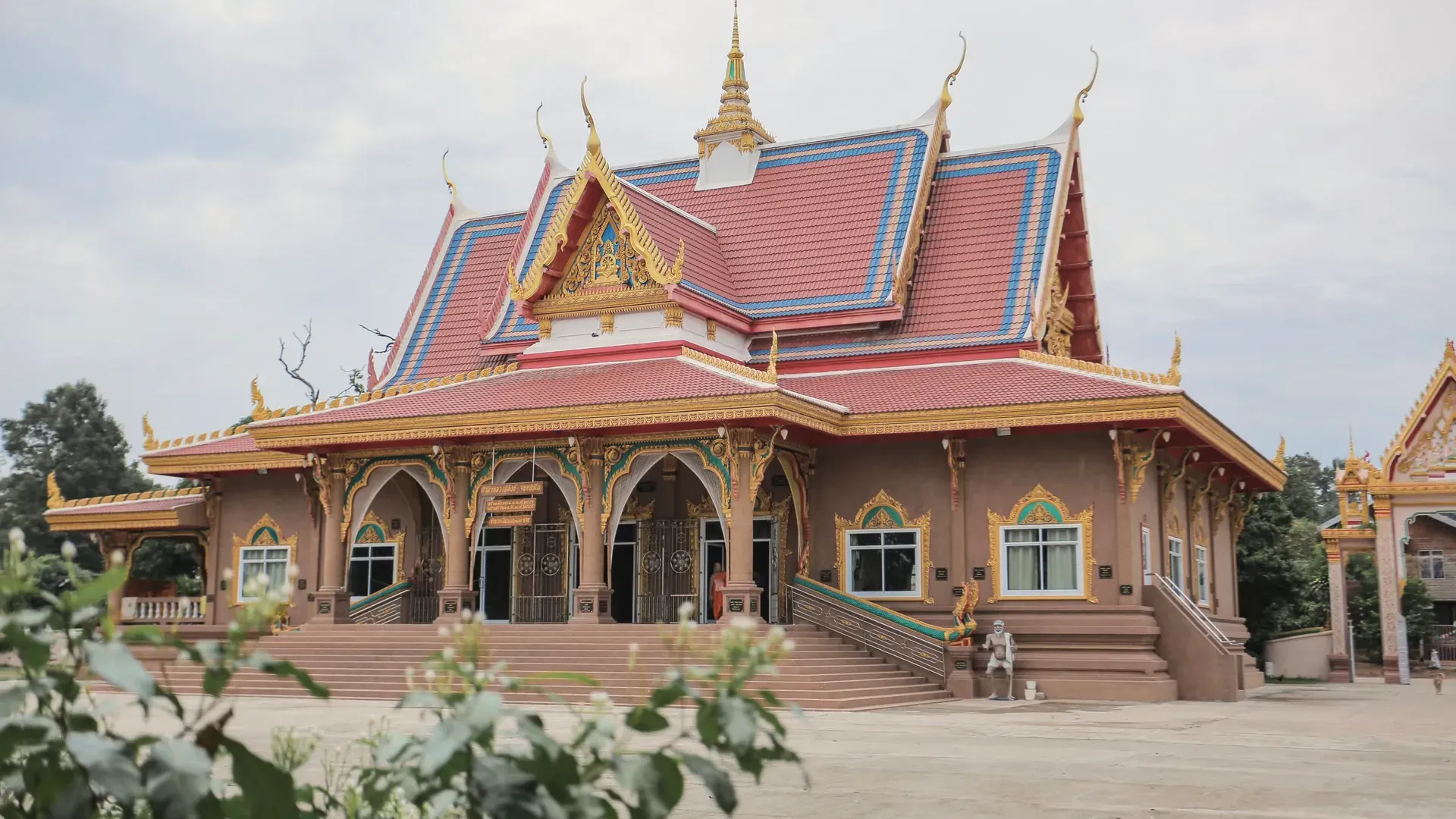
A temple in the middle of Roi Et town with a walking Buddha of reinforced concrete, standing nearly 60 metres without its base, which is about 8 metres high. TAT says visitors can climb a staircase inside to knee height, and describes the statue as widely revered by locals.
Registered ancient monument
An ancient monument inside Wat Ku Phra Kona in Sa Khu subdistrict, Suwannaphum district. The Fine Arts Department records it under the older names Ku Si Chaeng and Ku Kham Kuna, and says it announced the registration in the Royal Gazette on 8 March 1935 (B.E. 2478). The page we could read says nothing more on its age or builders.
Khmer sanctuary
TAT describes Ku Kasing as a large Khmer sanctuary dating from the 11th century, about 60 kilometres outside the provincial town. The Ministry of Commerce places it in Kaset Wisai district, next to the sanctuary Ku Ka Don.
Lake
A freshwater lake of 7,500 rai in Bueng Kluea subdistrict, Selaphum, about 10 kilometres east of the district town. TAT says it has water all year, a white sand beach nearly one kilometre long on the west shore and a bird conservation role. The name comes from salt crystals that once formed in the dry season.
Modern chedi
A very large chedi at Wat Pha Nam Thip Thep Prasit Wararam in Pha Nam Yoi subdistrict, Nong Phok district, built under Phra Ajarn Si Mahaviro and designed with the Fine Arts Department. The Ministry of Tourism and Sports directory gives its height as 101 metres, 109 with the finial, and a cost of more than 3,000 million baht.
Plain and rice-growing area
A vast plain of the north-east that TAT says covers parts of five provinces, with about three-fifths of it in Roi Et districts Pathum Rat, Kaset Wisai, Suwannaphum and Phon Sai. It is now a major jasmine rice area and the site of a Land Development Department centre near Ku Phra Kona.
Roi Et is a regional city, not a village. The Ministry of Commerce lists 5 department stores, 5 building-materials centres, 4 cinemas, a walking street and wholesale shops in the provincial town, plus a provincial hospital called Roi Et Hospital, a bus station and an airport. That is a fuller set of services than most provinces on this list can show, but the list is from an undated page, so check what exists before you rely on it.
We did not find official figures for the foreign community, rents, house prices, internet quality, hospital beds or international schools, so we are not quoting any. Visit for more than a weekend, in more than one season, and talk to people who already live in the district you like. About four in five registered residents live outside municipal areas, so where you choose inside the province matters a lot for access to services.
BAANLYY does not have a rental hub or confirmed local listings in Roi Et, and it has no property managers there. This page is a reference guide and not a property search. Thai law limits what foreigners can own, and the rules for condominiums, leaseholds and company structures differ from one another, so read BAANLYY's ownership and visa guides and take advice from a qualified Thai lawyer before you commit money.
Your visa route matters more than the province you choose. BAANLYY's visa guides cover the long-stay options in plain language and cite the official Thai sources for each. Nothing on this page is legal, tax or immigration advice, and BAANLYY is a property portal and is not a party to independent owners', agents' or agencies' leases or sales.
We left these out rather than guess. If you hold a current official source for any of them, tell us at hello@baanlyy.com.
The NSO Statistical Yearbook 2025 counts 1,275,519 registered residents at the end of 2024, based on household registration. Registered residents are not the same as people living in the province day to day, so treat it as a guide.
It covers about 8,299 square kilometres on both the NSO and Ministry of Commerce figures. It has 20 districts, with Mueang Roi Et as the provincial centre. The two sources differ by one subdistrict and one village.
The Ministry of Commerce gives about 512 kilometres by road. There is also an airport in Thawat Buri district, 11 kilometres from the town, though you should check current flights because we could not confirm a schedule.
It is a broad plain in the north-east that TAT says covers parts of five provinces, mostly in Roi Et. The name means the plain where the Kula traders cry. It is now a main area for growing jasmine rice.
Jasmine rice, silk and cotton cloth, the Isan khaen, rocket festivals in May and June, and big Buddha images such as the walking Buddha at Wat Burapha Phiram. Khmer-era sanctuaries such as Ku Phra Kona and Ku Kasing are also on the sources' lists.
No. Roi Et is landlocked and does not border Laos. The Ministry of Commerce lists Kalasin, Mukdahan, Yasothon, Si Sa Ket, Surin and Maha Sarakham as its neighbours. The nearest Mekong crossing is in another province.
No. BAANLYY has no rental hub, listings or property managers in Roi Et yet. This page is a reference guide built from Thai government sources, and it is not a property search.
Facts on this page were checked against the sources above on 2026-10-12. Official figures change; confirm current numbers and rules with the relevant authority before relying on them.
BAANLYY LLC is a Nevada property portal. Homes are listed by independent owners, agents and agencies; BAANLYY is not a party to their leases or sales. Owners who contact BAANLYY directly can have their home listed and managed by the BAANLYY founding team under a written agreement. General information, not legal, tax, immigration or financial advice.