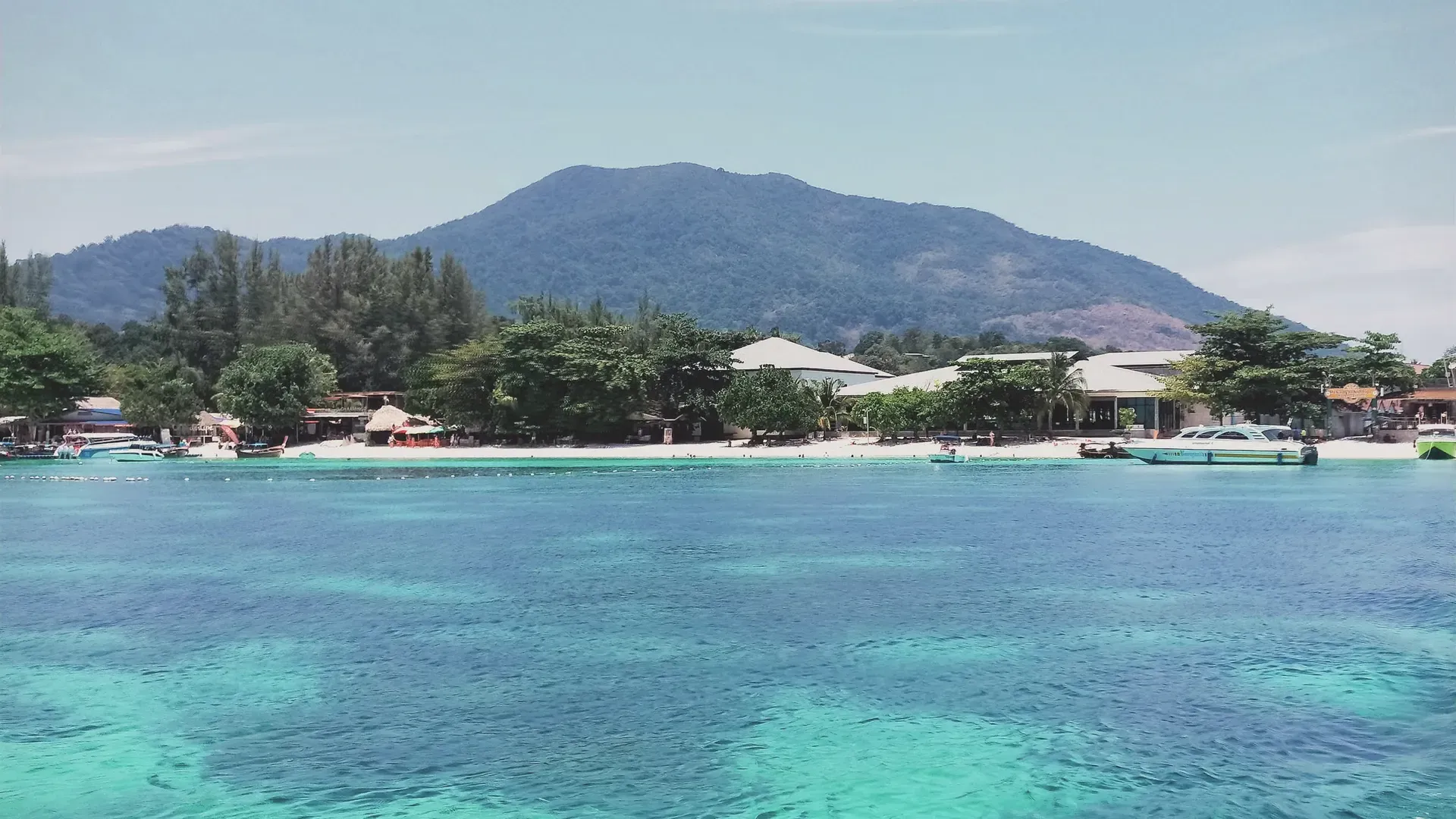
Thailand · South · Satun
Satun (สตูล)
Satun is Thailand's southwestern-most province, on the Andaman coast against the Malaysian border, with a UNESCO geopark and Tarutao's islands. Facts here come from Thai government and UNESCO sources.
Satun is Thailand's southwestern-most province, on the Andaman coast against the Malaysian border, with a UNESCO geopark and Tarutao's islands. Facts here come from Thai government and UNESCO sources.
Satun had 324,086 people in the civil registration system in August 2026 (323,666 Thai nationals and 420 registered non-Thai nationals), according to the Department of Provincial Administration. That is the 67th largest registered population of Thailand's 77 provinces and about 0.5 percent of the national registered total of 65,677,170.
This is the number of people entered in the house registration system for the province, not a count of everyone who lives there. People who work in another province often stay registered at home, and most foreigners on short stays are not in the registry at all. Official table for August 2026 (read by BAANLYY on 14 November 2026) · Compare all 77 provinces
Satun is the last province on Thailand's Andaman coast before the Malaysian border. The National Statistical Office's 2025 provincial report puts it about 973 kilometres from Bangkok, with an area of roughly 2,807.5 square kilometres. Malaysia's states of Perlis and Kedah lie to the south and east, and Songkhla, Phatthalung and Trang lie to the north. It is mostly hills in the north and east, a thin coastal plain, mangrove, and a scatter of islands that includes the Tarutao and Adang-Rawi groups.
It is a small, quiet province. The report, citing the Department of Provincial Administration, counts 324,879 registered residents at the end of December 2024 across seven districts, with only 61,574 of them living inside municipal areas. It counts 243 mosques, 43 Buddhist temples and 3 Christian churches, so mosques outnumber temples by a wide margin, though the report gives no religious breakdown of residents. The economy is mainly farming, fishing and small-scale tourism.
Who is it for? People who want sea, caves and islands with far fewer visitors than Phuket or Krabi, and who are comfortable in a small provincial town where the nearest big hospital and airport are in other provinces. It is a poor fit if you need a large foreign community, a deep rental market or international-standard hospitals on your doorstep, because we found no official figures for any of those. BAANLYY does not yet have local listings in Satun, so treat this page as a reference guide and not a property search. What we could not confirm is listed openly at the bottom.
| Region | Southernmost western Thailand, on the Andaman Sea coast, bordering Malaysia to the south source |
|---|---|
| Area | About 2,807.5 square kilometres (1,549,361 rai), or 3.5 percent of southern Thailand, according to the NSO provincial report 2025 source |
| Registered population | 324,879 registered residents at the end of December 2024 (161,667 men and 163,212 women), Department of Provincial Administration figure quoted by the NSO source |
| Administrative divisions | 7 districts, 36 subdistricts and 280 villages (2024) source |
| Distance from Bangkok | About 973 kilometres, according to the NSO provincial report source |
| Gross provincial product | 33,152 million baht in 2023, or 110,312 baht per person, ninth in the southern region and 45th nationally (NESDC figures quoted by NSO) source |
| Weather in 2024 | Average temperature 28.67 degrees Celsius, average relative humidity 78.2 percent, 2,048.5 millimetres of rain on 150 rain days source |
| UNESCO Global Geopark | Satun UNESCO Global Geopark, designated in 2018, covering 259,700 hectares across two national parks and a wildlife sanctuary source |
| Mu Ko Phetra National Park | 308,987 rai in total, about 22 islands, with its office at Ao Nun, Pak Nam subdistrict, Langu district source |
Satun sits at the far southwestern corner of Thailand. The NSO report says it borders Rattaphum district of Songkhla, Pa Bon in Phatthalung and Palian in Trang to the north, the Malaysian states of Perlis and Kedah to the south, Sadao district of Songkhla and Perlis to the east, and the Andaman Sea to the west. It makes up about 0.5 percent of Thailand's land area.
The north and east are tangled mountains, mainly the Banthat range and the Sankalakhiri range, and the land tilts gently down to the sea on the west and south. A narrow plain runs alongside the coast, and beyond it is salt-water mangrove, The report points out something unusual: no river flows through the province. There are only short streams that start in the northern and eastern hills.
Forest is a large part of the map. The report lists 18 national reserve forests covering 758,228 rai, which is 48.9 percent of the province, made up of 13 inland forests and 5 mangrove forests. It also notes that, of the minerals found in Satun, including barite, antimony, tin, lead and iron, the only mining open in the current year is limestone quarrying for construction. Offshore, Tarutao and Adang-Rawi make up the main island groups, and Mu Ko Phetra National Park adds about 22 islands, many of them steep limestone with caves and sinkholes according to the Department of National Parks.
Satun has an equatorial, hot and humid climate with heavy rain and, as the NSO report describes it, two seasons: a short hot season from January to April and a rainy season from May to December. In 2024 the province recorded an average temperature of 28.67 degrees Celsius, average relative humidity of 78.2 percent, and 2,048.5 millimetres of rain over 150 rain days, an average of 13.7 millimetres on a rainy day.
The Department of National Parks describes the Mu Ko Phetra islands as having a tropical monsoon climate shaped by the southwest, northwest and southeast monsoons, with weather that is similar through the year and a long rainy season from about May to November. That is a slightly different span from the NSO's May to December, so treat the edges of the wet season as approximate.
For a visitor or a would-be resident the practical point is that rain is normal for most of the year. Island boats and park access depend on sea conditions, which the sources we opened do not give month by month. The figures above are single-year readings, not the Thai Meteorological Department's official 30-year normals, which we could not retrieve.
The NSO report says nothing is recorded about a town called Satun before or during the Ayutthaya period, and it presumes there were only small villages scattered along the coastal plain. In the early Rattanakosin period Satun was a district inside the old Muslim city-state of Saiburi (Kedah), and its history is tied to that city's. The report quotes the Rattanakosin chronicles on a governor, Phraya Abhaiburi, who answered more to Nakhon Si Thammarat than to Kedah.
The borders were fixed in the colonial era. The report states that in 1897 Saiburi, Perlis and Satun were organised as a single Saiburi circle, and that Satun was separated from Saiburi under the Anglo-Siamese treaty signed in Bangkok on 10 March 1909. The treaty passed Saiburi and Perlis to Britain and left Satun with Thailand. It became a fourth-class town within the Phuket circle on 6 August 1910, and a province after the change of government in 1932.
The name comes from the Malay word setoi, meaning santol, a local fruit, according to the report. The old Malay name quoted there, Negeri Setoi Mumbang Segara, is translated as Satun, the city of the sea god, which is why the province seal shows a sea deity. The report gives the provincial slogan as Satun, peaceful, clean, pure nature, the provincial flower as the kalong and the provincial tree as the mak phlu tak-kataen. UNESCO adds that Satun's living traditions include the Pe-Bo spirit ceremony and the Loi Rue boat-floating festival of the Urak Lawoi sea people, and the Nora dance, which it calls part of Thailand's intangible cultural heritage.
The NSO report describes Satun as an agricultural economy. It quotes the National Economic and Social Development Council for 2023: gross provincial product of 33,152 million baht, or 110,312 baht per person, which ranks ninth in the south and 45th in the country. Those are the headline numbers we could confirm. We did not open a sector breakdown, so we do not state how much comes from farming, fishing or tourism.
Industry is small. The report, citing the provincial industry office, counts 186 industrial establishments in 2024 with registered capital of 4,767.44 million baht and 4,372 workers. Mining is limited to limestone quarrying for construction. The report lists community-based tourism villages across the province, among them Ban Hua Thang, Ban Ketri, Bakan Yai, Ban Hua Hin and Ban Bu Boi, which offer boat trips through the mangroves, fishing-village stays and cooking and craft activities.
The border matters to the local economy as well. Provincial highway 4184 connects Khuan Sato to Perlis in Malaysia, the report says, and the park at Thale Ban has a border market where people from both countries trade goods. The province also has ferry piers at Tammalang, Chebilang and Pak Bara used for cross-border freight and tourism. We did not find trade-value figures in the pages we opened, so we cannot say how large this trade is.
Satun is about 973 kilometres from Bangkok according to the NSO report. The report names the main roads: highway 406 (Yontrakarn Kamthon road) runs 67 kilometres from Satun town to the Phetkasem road (highway 4) at Rattaphum in Songkhla and on toward Phatthalung and Hat Yai, and highway 416 runs 151 kilometres from Chalung to Trang, passing Tha Phae, Langu and Thung Wa districts.
The Department of National Parks gives a driving route from Bangkok to Mu Ko Phetra: highway 4 through Phetchaburi, Prachuap Khiri Khan and Chumphon, then highway 41 through Nakhon Si Thammarat and Phatthalung, back onto highway 4, then highway 406 through Rattaphum, highway 4137 through Khuan Kalong and finally highway 416. The park office at Ao Nun is about 7 kilometres from Langu and about 56 kilometres from Satun town, it says. An alternative runs through Trang and Palian on highways 404 and 416.
By water, the report names three main piers: Tammalang and Chebilang in Mueang Satun district and Pak Bara in Langu district. The Department of National Parks says boats from Pak Bara reach Ko Hin Ngam and Ko Adang in about an hour. We did not open an official source on trains, flights or scheduled buses to Satun, so we do not state any here, and ferry timetables change with sea conditions, so check them locally.
Marine national park
The NSO report calls it the eighth national park and Thailand's first large marine park, covering 1,490 square kilometres and 51 islands in the Andaman Sea across two groups, Tarutao and Adang-Rawi. Ko Adang has the ranger station and visitor services; Ko Lipe nearby is home to Urak Lawoi sea people; Ko Hin Ngam is known for smooth stones that visitors are asked not to take. Boats leave from Pak Bara.
UNESCO Global Geopark
Designated in 2018, the geopark covers 259,700 hectares across two national parks and a wildlife sanctuary. UNESCO calls the area the Land of Palaeozoic Fossils, with rock from the Cambrian to the Permian. It says the trilobites on Tarutao Island are the oldest recorded in the Thai-Malay Peninsula, and that Prasat Hin Panyod is a pinnacle karst formation with a lagoon reachable by kayak.
Marine national park
A national park of 308,987 rai that spans coast, about 22 limestone islands and mainland hills, with its office at Ao Nun in Langu district. The Department of National Parks lists nature trails, birdwatching, kayaking, snorkelling and camping, notes that there is no restaurant or shop so visitors should bring supplies, and reports that most park lodging was closed for renovation when we looked.
National park
The NSO report says this was Thailand's twentieth national park, covering 196 square kilometres in Khuan Don district with an extension into Mueang Satun. It holds both mountain and mangrove, mostly evergreen and mixed deciduous forest, and sits on the Malaysian border, where a border market lets people from both countries trade.
Historic building and museum
The NSO report says this two-storey brick-and-plaster mansion was begun in 1898 and finished in 1916 by Phraya Phumi Narathibhakdi, the governor of Satun. It was built to house King Chulalongkorn, who never stayed there, and later served as a residence and as the provincial hall during the Second World War. Today it is a museum of local art, culture and daily life.
Limestone cave
According to the NSO report this cave has a high ceiling and at least 20 named chambers, among them the Curtain Room, the Coral Room, the Mushroom Room and the Pagoda Room, lined with stalactites and stalagmites that glitter. The report lists the Ban Phu Pha Phet community, which offers forest walks, rafting and homestays nearby.
Waterfall and river rafting
The NSO report places this waterfall in Nam Phut subdistrict, Langu district, about 26 kilometres by road from the Langu to Satun road junction or about 19 kilometres from Thung Wa. It adds that the Lamlon stream has a rafting course of about 8 kilometres through some 16 rapids and can be run all year.
Public services in Satun are small but complete on paper, according to the NSO report. For health it counts one general hospital (Satun Hospital), six community hospitals (one in each other district), 55 subdistrict health-promoting hospitals and 161 clinics. It counts 115 doctors, 33 dentists and 791 nurses, a ratio of one doctor to 2,827 people. Anything serious that Satun cannot treat is a trip to another province, and we found no official source on referral routes or on private hospitals.
Education and religion are listed too. In the 2024 school year the province had 218 schools, 4,221 teachers and 59,355 pupils. The report records 243 mosques, 43 temples, 33 monasteries and 3 Christian churches. On utilities, 108,278 customers used electricity in 2024, 30,556 households drew piped water, and 278,600 mobile numbers were active, of which 242,940 used the internet.
What we cannot give you is cost of living, typical rents, broadband speeds, the quality of the hospitals, or the size of the foreign community. We found no official source for any of them. If you are thinking of living here, visit in more than one season, including the rainy months, and talk to people who already do. Satun is near the Malaysian border, so check entry and visa rules for any trip across it with the official Thai and Malaysian authorities.
BAANLYY does not run a rental hub or local listings for Satun, so this page is a reference guide and not a property search. Thai law limits what foreigners can own, and the rules for condominiums, leaseholds and company structures differ from one another, so read BAANLYY's ownership and visa guides and take advice from a qualified Thai lawyer before you commit money.
Large parts of Satun are national park, reserve forest, mangrove and sea. The NSO report counts 48.9 percent of the province as national reserve forest. That is a reason to check carefully what kind of land title any parcel has, and to confirm it with the local land office, before you pay a deposit. Island land in particular is often inside park boundaries.
Your visa route matters more than the province you choose. BAANLYY's visa guides cover the long-stay options in plain language and cite the official Thai sources for each. Nothing on this page is legal, tax or immigration advice, and BAANLYY is a property portal and is not a party to independent owners', agents' or agencies' leases or sales.
We left these out rather than guess. If you hold a current official source for any of them, tell us at hello@baanlyy.com.
The NSO provincial report 2025 gives about 2,807.5 square kilometres and 324,879 registered residents at the end of December 2024, across seven districts.
The NSO report says about 973 kilometres. The Department of National Parks describes a driving route along highways 4, 41, 406 and 416.
It is a UNESCO Global Geopark designated in 2018, covering 259,700 hectares across two national parks and a wildlife sanctuary, known for fossils from the Cambrian to the Permian.
By boat. The Department of National Parks says boats from Pak Bara reach Ko Hin Ngam and Ko Adang in about an hour. Check current schedules locally, as they depend on sea conditions.
Hot, humid and wet. The NSO report counts 2,048.5 millimetres of rain on 150 rain days in 2024, with a short hot season from January to April and rain from May to December.
Yes. The NSO report lists Satun Hospital as the general hospital and six community hospitals, plus 55 health-promoting hospitals and 161 clinics. It gives no data on quality or specialist care.
Not yet. BAANLYY has no local listings or property managers in Satun, so this page is a reference guide. Check land title and access yourself, and take advice from a Thai lawyer.
Facts on this page were checked against the sources above on 2026-10-12. Official figures change; confirm current numbers and rules with the relevant authority before relying on them.
BAANLYY LLC is a Nevada property portal. Homes are listed by independent owners, agents and agencies; BAANLYY is not a party to their leases or sales. Owners who contact BAANLYY directly can have their home listed and managed by the BAANLYY founding team under a written agreement. General information, not legal, tax, immigration or financial advice.